Het lijkt erop dat deze dienst tijdelijk niet beschikbaar is

Ik zal ruimtelijke data-analyse en mapping uitvoeren in QGIS of ArcGIS

F
ftff2003
F
ftff2003
Francisco F.
Sommige informatie is automatisch vertaald.

Over deze dienst

Automatische vertaling

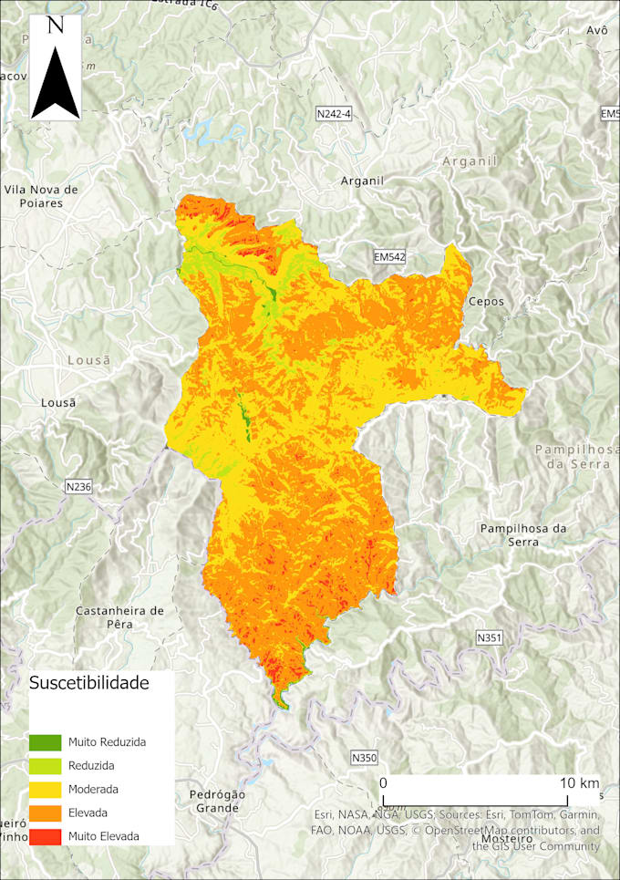
Ik bied professionele GIS-diensten op maat van jouw ruimtelijke data behoeften. Met een achtergrond in Geografie en een master in Geografische Informatiesystemen en Ruimtelijke Modellering, breng ik sterke expertise in mapping, geodata verwerking en ruimtelijke analyse. Ik werk met QGIS, ArcGIS, Python en open data om hoogwaardige kaarten, inzichtelijke analyses en reproduceerbare workflows te leveren. Of je nu thematische cartografie, milieuanalyse, stedelijke modellering of geospatiale automatisering nodig hebt, ik zorg voor precisie, duidelijkheid en snelle levering.

Maak kennis met Francisco F.

Francisco F.
  • Afkomstig uitPortugal
  • Lid sindsjul 2025
  • Talen

    Portugees, Engels, Spaans
I am a Master’s student in Geographic Information Systems and Spatial Modeling for Planning at the University of Lisbon (IGOT), with a Bachelor's degree in Geography. My academic and project experience reflect a strong foundation in spatial data analysis, urban modeling, and the integration of GIS with programming tools such as Python. I have a particular interest in applying geospatial technologies to support sustainable territorial management, environmental monitoring, and smart urban development. I am confident working with tools like QGIS, ArcGIS, and remote sensing software, and I act

Automatische vertaling