Door categorieën bladeren
Ontdekken
Fiverr Pro
Nederlands
$
USD


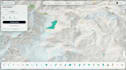
Need an interactive web map to visualize your geographic data? I can build custom WebGIS applications that make your spatial data easy to explore and understand.
My services include:
What you'll receive:
I can help turn your GIS datasets into clear, engaging web maps for research, portfolios, reports, and public-facing projects.
Please contact me before ordering to discuss your data, required features, and project scope. Complex backends, databases, user authentication, and advanced functionality may require a custom offer.
Let erop dat het tegen het beleid van Fiverr voor freelancers is om thema's, templates of andere elementen in het geleverde werk op te nemen die inbreuk maken op de rechten van derden of toepasselijke wetten. Lees er meer over in onze Gids voor verantwoorde digitale creatie.
Geospatial Analysis, Cartography, WebGIS
Talen


