Door categorieën bladeren
Ontdekken
Fiverr Pro
Nederlands
$
USD


Automatische vertaling
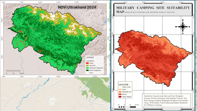
Ik maak professionele vegetatie- en klimaatindexkaarten (NDVI, SAVI, LST, NDWI) en voer Landgebruik/Landbedekkingsclassificatie (LULC) uit met verandering detectie over tijd met satellietgegevens (Landsat, Sentinel, MODIS). Mijn diensten variëren van eenvoudige vegetatie-analyse tot meerjarige spatio-temporale studies met gedetailleerde rapporten. Je ontvangt nauwkeurige, publicatieklare kaarten, shapefiles en datasets op maat voor onderzoek, planning of milieumonitoring.
GIS analyst and specialist
Talen
Automatische vertaling
Automatische vertaling
Welke outputs krijg ik?
Je ontvangt publicatieklare kaarten (PDF/PNG), GIS-compatibele lagen (GeoTIFF, Shapefile) en een samenvattend rapport. Hogere pakketten bevatten gedetailleerde analyse en presentatie slides.
Bied je aangepaste vegetatie/klimaat indexen aan die niet in de lijst staan?
Absoluut. Ik kan aangepaste indexen berekenen (bijvoorbeeld EVI, NDBI, NDMI) op basis van jouw onderzoek of projectvereisten.
Kun je het werk afstemmen op mijn scriptie/research publicatiestandaarden?
Ja, ik heb ervaring met academisch onderzoek en kan kaarten, data en rapporten leveren in formaten die geschikt zijn voor journalpublicatie of academische indiening.