Door categorieën bladeren
Ontdekken
Fiverr Pro
Nederlands
$
USD



Automatische vertaling
Moet je je GIS-workflow automatiseren?
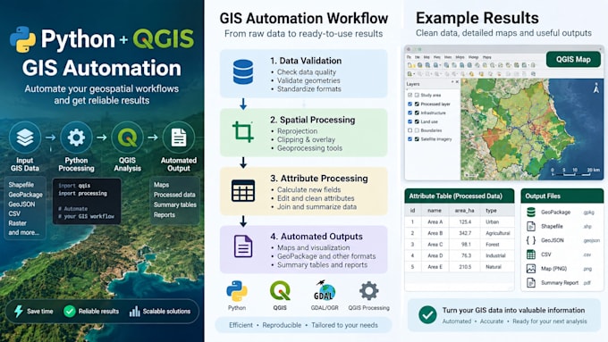
Ik ontwikkel Python- en QGIS-oplossingen om repetitieve GIS-taken te automatiseren, geospatiale data te verwerken en de efficiëntie van je workflow te verbeteren.
Ik kan helpen met:
GIS-gegevensverwerking en conversie
Ruimtelijke analyse en geoprocessing
Attribuut- en laagbeheer
Data-validatie en kwaliteitscontroles
Geautomatiseerde GIS-workflows met Python
QGIS Processing-workflows
GeoPackage en andere GIS-gegevensformaten
Ik richt me op het maken van praktische, betrouwbare en reproduceerbare GIS-oplossingen die op jouw wensen zijn afgestemd.
Tools: Python, QGIS, QGIS Processing, GDAL/OGR.
Neem contact met mij op voordat je bestelt, zodat we je wensen kunnen bespreken en het juiste pakket voor je project kunnen kiezen.
GIS Analyst ArcGIS Python
Talen
Automatische vertaling