Het lijkt erop dat deze dienst tijdelijk niet beschikbaar is

I will do cadastral mapping using gis tools

A
aqsaasim9
A
aqsaasim9
Aqsa
Sommige informatie wordt in het Engels weergegeven.

Over deze dienst

Hi Everyone;

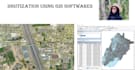
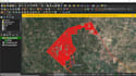
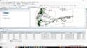
We are having Remote Sensing and Geographic Information System(GIS) professionals with more than 5 years of experience in the GIS field. We have done many projects from creating GIS maps in Arcgis, QGIS(QGIS), and several other software. 


 We'll offer the following services for you;


  • Spatial analysis with ArcGIS, ArcGIS Pro, QGIS etc
  • Shapefile, Feature Class, Geodatabase, kml, Topology etc
  • Digitization of Point, Lines, and Polygon in Vector format.
  • Road Network Analysis.
  • Raster and Vector data Analysis.
  • Satellite image processing
  • Geocoding & reverse Geocoding
  • Parcel mapping
  • Parcel Fabric Model
  • Georefrencing


And much more.


Are you looking to outsource some of your GIS operations or looking for a GIS consultant? Feel free to contact us. We shall be providing the above services, timely and accurate to meet your needs, and ultimately to your satisfaction! Trust me, you'll definitely come back again!

Maak kennis met Aqsa

Aqsa
  • Afkomstig uitPakistan
  • Lid sindsaug 2023
  • Talen

    Urdu, Engels
As a GIS & Remote Sensing Specialist, I excel on Fiverr. Offering expertise in ARCGIS, ARCGISPRO, QGIS, Google Earth Engine, and more, I cater to a global clientele. Count on top-tier customer service, rapid responses, high-order completion, and stellar reviews. Let's map out success together!