Door categorieën bladeren
Ontdekken
Fiverr Pro
Nederlands
$
USD

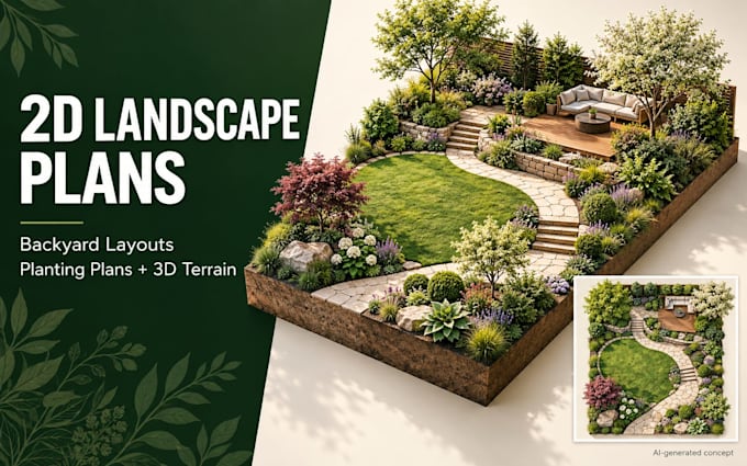
Need a clear 2D landscape plan to organise your backyard? Want planting and terrain views that make your outdoor ideas easier to understand?
I create coordinated backyard layouts, planting plans and 3D terrain models tailored to your site information and priorities.
What You'll Get;
Scope of Work;
Using AutoCAD, SketchUp and Lumion, I focus on readable drawings, practical layouts and consistent deliverables.
Concept planning only; surveying, engineered grading, drainage and permit documentation are excluded.
Message me with your site size and files for the right package.
Laat het de freelancer weten als je voorkeuren voor of zorgen hebt over het gebruik van AI-tools voor het voltooien en/of leveren van je bestelling.
Achitecture exert
Talen
What information do you need to start?
Please provide a measured site plan or sketch, photos, location, existing features, preferred style and required garden uses. Planting work also needs sunlight, soil and maintenance information.
What is the difference between planting zones and a planting plan?
Zones show where planting belongs. A planting plan identifies proposed species, positions, quantities and spacing, with a corresponding schedule.
Do I need a topographic survey for terrain modelling?
Reliable contours or spot levels are required to represent actual terrain. Without them, I can only create an illustrative terrain concept, clearly labelled as such.
Are these construction or permit blueprints?
These packages provide landscape concept drawings. “Blueprint” refers to the drawing presentation; engineered construction details, permit certification and approval are not included.
