Door categorieën bladeren
Ontdekken
Fiverr Pro
Nederlands
$
USD


Automatische vertaling
Ben je op zoek naar een professionele GIS-expert om je ruwe ruimtelijke data om te zetten in mooie, inzichtelijke kaarten? Je bent op de juiste plek!
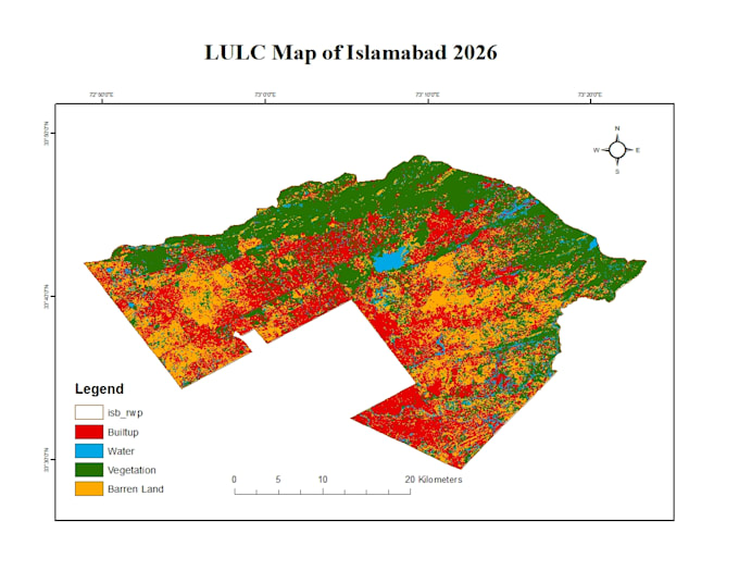
Ik bied hoogwaardige Geographic Information Systems (GIS), Land Use/Land Cover (LULC) classificatie en geavanceerde ruimtelijke dichtheid heat maps die zijn afgestemd op jouw specifieke projectbehoeften, of het nu gaat om stedelijke planning, milieustudies, vastgoed of bedrijfsanalyse.
Wat ik voor jou kan doen:
Tools & Software die ik gebruik:
Waarom kiezen voor mij?
Professional GIS Mapping and ArcGIS Digitization
Talen
Automatische vertaling
Automatische vertaling
Welke data of invoer moet ik aanleveren om te beginnen?
Lever je projectvereisten, studiegebied (coördinaten of locatie naam) en alle beschikbare data die je hebt (bijvoorbeeld Shapefiles, KML/KMZ, CSV-coördinaten of ruwe Excel-bestanden). Als je geen data hebt, laat me dan je doelstellingen weten, dan kan ik openbare satellietbeelden of open-source data zoeken.
Welke software en tools gebruik je voor de analyse?
Afhankelijk van de projectvereisten gebruik ik vooral industry-standard software zoals ArcGIS Pro, ArcMap, QGIS en Google Earth Engine (GEE) voor intensieve remote sensing en grootschalige data verwerking.
Kun je tijdreeks- of veranderingdetectie analyses uitvoeren voor LULC?
Ja! Ik voer veranderingdetectie uit voor Land Use/Land Cover (LULC) over verschillende jaren (bijvoorbeeld 2015 versus 2025) met behulp van historische Landsat- of Sentinel-satellietbeelden om stedelijke groei, ontbossing of milieuwijzigingen te tonen.
In welke bestandsformaten lever je de uiteindelijke kaarten en data aan?
Ik lever kaarten in hoge resolutie in standaard visuele formaten (PDF, JPEG, PNG) die klaar zijn voor presentaties of rapporten. Daarnaast kan ik de bron ruimtelijke data leveren in formaten zoals Shapefile (.shp), GeoJSON, KML/KMZ of Raster/TIFF, afhankelijk van je pakket en wensen.
Bied je aangepaste opdrachten aan als mijn project niet binnen je pakketten past?
Absoluut! GIS-projecten variëren sterk in complexiteit. Stuur me gerust een bericht met je specifieke projectdetails, en ik maak een op maat gemaakte offerte die perfect past bij je budget en planning.