I will digitize features, polygons from maps or satellite images

A
ashwaniejayasin
A
ashwaniejayasin
Ashwanie

Level 1

1 bestelling in wachtrij

Sommige informatie wordt in het Engels weergegeven.

Over deze dienst

Hi and Welcome to my Gig!


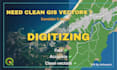
Need accurate GIS layers from maps or satellite images?

I'll digitize your features in ArcGIS or QGIS to produce clean, ready-to-use vector data. With experience in GIS, remote sensing, and environmental mapping.
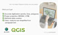

Services I Offer:

  • Digitizing points, lines, or polygons from maps or satellite images
  • Creating shapefiles, GeoJSON, or GeoPackage outputs
  • Attribute table creation (with names, codes, or IDs)
  • Layer organization and symbology for easy map use
  • Coordinate system and projection setup (EPSG as per your need)


What You'll Receive:

  • Neat, topologically correct vector layers
  • Correct projection (UTM, WGS84, etc.)
  • Attribute data (if provided)
  • Final files in your preferred format (SHP, GPKG, KML, or GeoJSON)


Why Choose Me:

  • Skilled in ArcGIS, QGIS, and Google Earth Engine
  • Detail-oriented and accurate mapping
  • On-time delivery and professional communication
  • Flexible: I handle both small and large mapping tasks
  • I also welcome long-term collaborations and confidential projects.


I can customize packages to fit your needs. Please contact me before placing an order to discuss your project.


Cheers!


Ashwanie

Maak kennis met Ashwanie

Ashwanie

GIS Specialist with a Background in Marine Sciences

5,0(14)

Level 1

  • Afkomstig uitSri Lanka
  • Lid sindssep 2024
  • Gem. reactietijdBinnen 6 dagen
  • Laatste levering1 week
  • Talen

    Engels
Passionate GIS and Remote Sensing specialist, skilled in mapping, spatial analysis, and remote sensing applications using ArcMap and QGIS. I excel at transforming complex data into clear, actionable insights. With a background in marine and environmental sciences, I bring a unique perspective to geospatial projects. Committed to accuracy and high-quality results, I tailor solutions to meet your specific needs. Let’s connect and bring your data to life with smart mapping solutions!

Mijn portfolio