Door categorieën bladeren
Ontdekken
Fiverr Pro
Nederlands
$
USD

Automatische vertaling
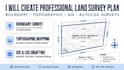
Professionele GIS Mapping | Land Survey Plan | AutoCAD & ArcGIS Expert*
Ben je op zoek naar nauwkeurige en hoogwaardige GIS mapping en land survey diensten?
Ik ben een professionele GIS-analist en landmeter met meer dan 5 jaar ervaring in het maken van precieze kaarten voor landdocumentatie, onroerend goed, landbouw en ontwikkelingsprojecten.
*WAT JE KRIJGT:*
- Hoogwaardige GIS-kaart (JPEG, PDF, PNG)
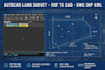
- AutoCAD-tekening (DWG, DXF)
- Shapefile (SHP) en KML/KMZ
- Georeferentieerde kaarten
- Afdrukklare lay-out
*MIJN DIENSTEN:*
- Land survey map / locatieplan
- Topografische kaart
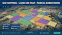
- GIS mapping & data conversie
- Digitalisering & georeferentie
- KML naar SHP / SHP naar KML
- GPS-gegevensverwerking
*Tools die ik gebruik:* ArcGIS, QGIS, AutoCAD, Google Earth Pro, Global Mapper
Snelle levering, onbeperkte revisies totdat je tevreden bent, en 100% nauwkeurigheid gegarandeerd!
Neem contact met me op voordat je bestelt voor gratis advies.
---
Licensed Land Surveyor AutoCAD GIS and Land Documentation Expert
Talen
Automatische vertaling
Automatische vertaling
Wat heb je nodig om mijn project te starten?
Ik heb je locatiecoördinaten, schets of beschrijving van het gebied nodig, en in welk formaat je het wilt.


