Door categorieën bladeren
Ontdekken
Fiverr Pro
Nederlands
$
USD

Automatische vertaling
Heb je professionele WebGIS apps, interactieve dashboards of aangepaste
webkaarten nodig voor jouw project?
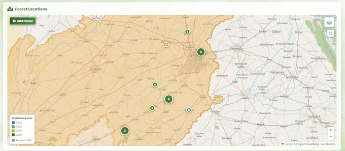
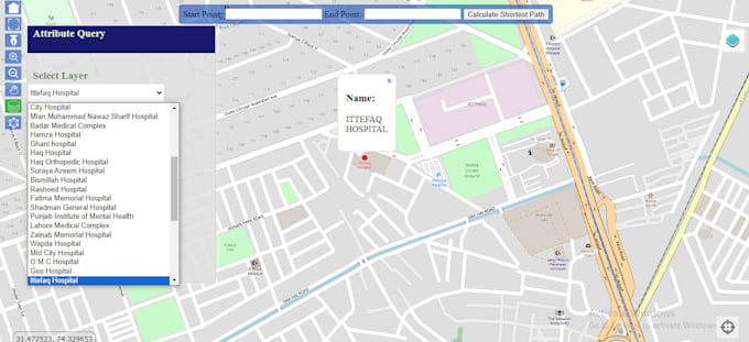
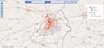
Ik bouw WebGIS applicaties, interactieve dashboards en aangepaste web
kaarten die aansluiten bij jouw behoeften aan ruimtelijke data. Of je nu een eenvoudige
interactieve kaart of een volledig data-gestuurd dashboard nodig hebt, ik help je graag. Krijg
precieze, interactieve en gebruiksvriendelijke WebGIS oplossingen snel geleverd.
Als GIS-specialist met een MPhil in GIS en meer dan 5 jaar ervaring, bied ik hoogwaardige WebGIS ontwikkeling met behulp van Leaflet, Mapbox, PostGIS,
en ArcGIS. Of het nu gaat om vastgoedmapping, landregistraties, bosmonitoring of stedelijke planning, ik kan het bouwen.
De diensten omvatten:
Interactieve Web Kaarten & Dashboards
WebGIS Apps met Leaflet, Mapbox, ArcGIS
Siteplan & Landregistratie overlays
Ruimtelijke data-analyse & visualisatie
GeoJSON, Shapefile, KML, CSV Data-integratie
PostGIS database-integratie
Kaarten in websites embedden
Laten we jouw ruimtelijke data omzetten in een krachtig, interactief WebGIS
toepassing. Neem nu contact op voor een gratis
consultatie voordat je de bestelling plaatst!
GIS Developer Building Interactive Web Maps and Dashboards
Talen
Automatische vertaling
Automatische vertaling
Welke informatie moet ik delen voordat we starten met het project?
Stuur gewoon je bestaande ruimtelijke data (indien aanwezig), een korte uitleg over wat de kaart of het dashboard moet tonen, en eventuele referentiesites die je leuk vindt.
Bouw je kaarten die ik direct in mijn website kan embedden?
Ja, ik lever kaarten en dashboards die klaar zijn om in elke website te worden ingebed, inclusief de code en integratiestappen.
Hoe verschilt een WebGIS dashboard van een gewone kaart?
Een gewone kaart toont alleen locaties, terwijl een WebGIS dashboard interactiviteit, filters, lagen en live data toevoegt die gebruikers kunnen verkennen.
Kan mijn dashboard automatisch worden bijgewerkt met nieuwe data?
Ja, live of vaak bijgewerkte databronnen kunnen worden gekoppeld zodat je dashboard veranderingen weergeeft zonder handmatige aanpassingen.
Met welke software en technologieën werk je?
Ik gebruik vooral Leaflet, Mapbox, PostGIS en ArcGIS, samen met moderne JS-frameworks afhankelijk van de projectbehoeften.