Door categorieën bladeren
Ontdekken
Fiverr Pro
Nederlands
$
USD

Level 1

Automatische vertaling
Als je op zoek bent naar GIS-diensten met ArcMap, bied ik verschillende opties aan:
1. Geo-spatiale analyse:
- Buffer creëren
- Clip-analyse
- Extractie met masker
- Topologische fouten verwijderen
- Ruimtelijke bewerkingen zoals Join, Union en Intersection
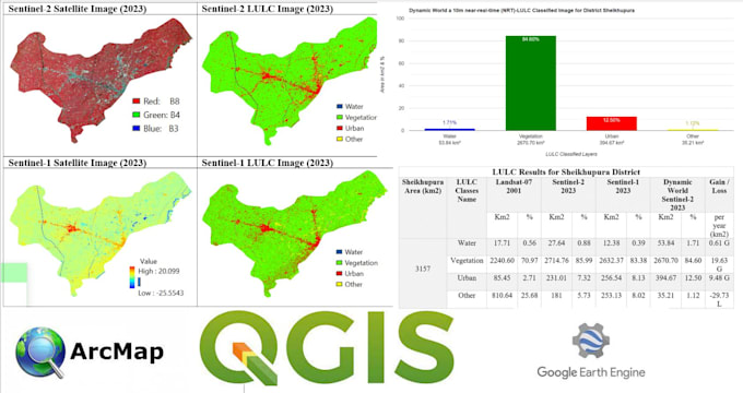
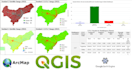
2. Landgebruik en landbedekkingsmapping
3. Attributen invoeren en data sorteren:
- Op basis van attributen
4. Vectorisatie & rasterisatie
5. Beeldanalyse:
- Classificatie
- Spectrale indices (bijv. NDVI, NDWI)
- Beeldcompositie
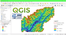
6. Model Builder taak
7. Thematic map maken
8. Data conversie tools:
- Shapefile, Feature Class, Geodatabase, KML
- Coördinatensysteem en projectie aanpassingen
9. Digitaleisering + georeferentie
10. Watershed analyse
Neem gerust contact met me op voordat je een bestelling plaatst om je specifieke wensen te bespreken. Ik help je graag met vragen of verzoeken gerelateerd aan GIS.
GIS and RS Analyst Python Google Earth Engine Arcpro Qgis
Level 1
Talen
Automatische vertaling
Automatische vertaling
Kun je kort uitleggen wat Geo Spatial Analysis inhoudt?
Geo Spatial Analysis houdt in dat je ruimtelijke relaties binnen geografische data onderzoekt. Dit omvat bewerkingen zoals buffering, clipping en ruimtelijke joins voor diepgaande analyse.
Wat is GIS?
GIS staat voor Geografisch Informatiesysteem. Het is een technologie die ruimtelijke of geografische data vastlegt, analyseert en presenteert.
Hoe werkt beeldclassificatie in GIS?
Beeldclassificatie houdt in dat pixels in een satelliet- of luchtfoto worden gecategoriseerd in verschillende klassen, wat helpt bij het identificeren van kenmerken zoals vegetatie, water of stedelijke gebieden.
Wat is Watershed analyse?
Watershed analyse beoordeelt de waterstroom over een bepaald gebied, identificeert bijdragende factoren en helpt bij waterbeheer.
Welke data kan worden geconverteerd met Data Conversion Tools?
Data Conversion Tools worden gebruikt om tussen verschillende GIS-dataformaten te converteren, zoals Shapefiles, Feature Classes, Geodatabases, KML, en voor het beheren van coördinatensystemen en projecties.