Door categorieën bladeren
Ontdekken
Fiverr Pro
Nederlands
$
USD


Automatische vertaling
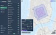
Heb je nauwkeurige geospatiale analyse of zinvolle inzichten nodig uit je ruimtelijke data? Je bent op de juiste plek.
Ik ben een GIS-gerichte ontwikkelaar met ervaring in ruimtelijke analyse, data verwerking en kaartcreatie met Python en professionele GIS-tools. Ik help om ruwe geografische data om te zetten in bruikbare inzichten en duidelijke visuele outputs.
WAT IK KAN DOEN:
TOOLS & TECHNOLOGIES:
Python (GeoPandas, Shapely, Rasterio), QGIS, ArcGIS, GDAL, PostGIS
WAAROM KIEZEN VOOR MIJ:
Ik werk samen met bedrijven, onderzoekers en particulieren om echte problemen op te lossen met geospatiale data.
Voel je vrij om me een bericht te sturen voordat je een bestelling plaatst om je project te bespreken.
Boston
Talen
Automatische vertaling
Automatische vertaling
Welke soorten analyses kun je uitvoeren?
Bufferanalyse, nabijheidsanalyse, ruimtelijke joins, overlays, heatmaps, clustering en meer.
Kun je GIS-workflows automatiseren?
Ja, ik kan Python scripts maken om repetitieve GIS-taken te automatiseren.
Welke dataformaten ondersteun je?
CSV, shapefiles, GeoJSON, rasterdata en meer.
Ontvang ik de verwerkte data?
Ja, alle resultaten (kaarten en datasets) worden geleverd.
Kun je de resultaten uitleggen?
Ja, ik bied een duidelijke uitleg of samenvatting afhankelijk van het pakket.
Werk je met grote datasets?
Ja, grote en complexe projecten worden behandeld in het Premium pakket.


