Door categorieën bladeren
Ontdekken
Fiverr Pro
Nederlands
$
USD

Automatische vertaling
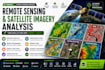
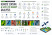
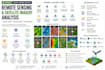
Ben je op zoek naar professionele remote sensing, satellietbeeldanalyse of Google Earth Engine (GEE) ondersteuning?
Ik bied end-to-end satelliet- en geospatiale analyse met behulp van Sentinel, Landsat, DEM en andere Earth observation data voor onderzoek, zakelijke, plannings- en milieutoepassingen.
De diensten omvatten:
Ik werk met Google Earth Engine, ArcGIS, QGIS, Python, Sentinel, Landsat, GDAL, Rasterio en GeoPandas.
Je ontvangt duidelijke, professionele kaarten, analyses en GIS-compatibele outputs die op jouw project zijn afgestemd.
Neem contact met me op voor grote gebieden, lange tijdreeksen of op maat gemaakte analyses.
GIS Developer
Talen
Automatische vertaling
Automatische vertaling
Met welke satellietbeelden kan ik werken?
Ik kan werken met Sentinel, Landsat en vele andere satelliet-, luchtfoto-, DEM- en Earth observation datasets, afhankelijk van jouw project en vereiste resolutie.
Kun je NDVI, NDWI, NDBI en andere spectrale indexanalyses uitvoeren?
Ja. Ik kan vegetatie, water, bebouwing en andere relevante spectrale indices berekenen en analyseren, en professionele kaarten en GIS-compatibele resultaten leveren.
Kun je landgebruik en landbedekkingsclassificatie uitvoeren?
Ja. Ik kan landbedekkingsmapping en classificatie-workflows bieden, afhankelijk van de beelden, studiegebied, klassen en nauwkeurigheidseisen.
Kun je satellietveranderingen detecteren?
Ja. Ik kan beelden van verschillende data vergelijken om stedelijke groei, vegetatieveranderingen, landbedekkingsveranderingen, waterveranderingen en andere ruimtelijke patronen te analyseren.
Werk je met Google Earth Engine?
Ja. Ik ontwikkel Google Earth Engine workflows voor satellietverwerking, spectrale indices, classificatie, tijdreeksanalyse, milieumonitoring en grote gebiedsanalyse.
Kun je een hele stad, regio of land analyseren?
Ja, afhankelijk van de vereiste analyse en dataset. Grote gebieden of lange tijdreeksen kunnen een op maat gemaakt aanbod vereisen, dus neem contact op voordat je bestelt.
Welke bestanden ontvang ik?
Afhankelijk van het project kunnen de outputs GeoTIFF, Shapefile, GeoJSON, GeoPackage, KML/KMZ, CSV/Excel, high-res kaarten en andere GIS-compatibele outputs omvatten.
Kun je een remote sensing taak uitvoeren die niet op de lijst staat?
Absoluut. Stuur me je studiegebied, doel en beschikbare data. Ik kan de vereisten beoordelen en een geschikte remote sensing workflow aanbevelen.


