Door categorieën bladeren
Nederlands
$
USD
Koppel je AI aan Fiverr




Automatische vertaling
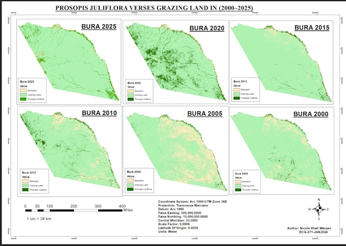
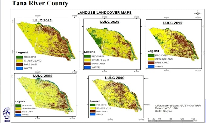
Ik lever professionele Land Use en Land Cover (LULC) classificatie en analyse met Google Earth Engine, ArcGIS Pro en QGIS. Ik werk met satellietbeelden om verschillende landbedekkings types te identificeren en in kaart te brengen, waaronder begroing, watervakken, bebouwde kavels, kale grond en landbouwgrond.
Mijn diensten omvatten Random Forest-classificatie, LULC-kaartvorming, multi-jaarlijkse veranderingsdetectie, nauwkeurigheidsbeoordeling, gebiedsbepaling en NDVI-analyse. Ik lever nauwkeurige, hoogwaardige kaarten en GIS-geleverde output om milieumonitoring, onderzoek en geïnformeerde besluitvorming te ondersteunen.
Laat me je helpen om satellietdata om te zetten in zinvolle geospatiale inzichten.
Geospatial Analyst
Talen
Automatische vertaling