Door categorieën bladeren
Ontdekken
Fiverr Pro
Nederlands
$
USD




Automatische vertaling
Hallo en welkom bij mijn dienst!
Ik ben een vierdejaars student Geologische Technologie en Geoinformatica met ruime praktische ervaring in GIS, remote sensing en ruimtelijke data-analyse. Ik ben gespecialiseerd in ArcMap, QGIS, SNAP en satellietbeeldverwerking, en lever nauwkeurige en goed gestructureerde geospatiale oplossingen.
Mijn diensten omvatten:
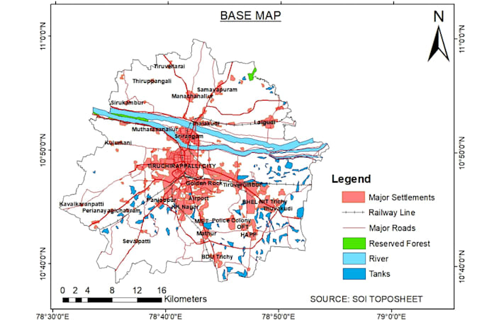
Professionele GIS-kaartcreatie
Ruimtelijke analyse (buffer, overlay, classificatie, interpolatie)
Satellietbeeldverwerking en workflows voor remote sensing
Digitalisering en georeferentie
Werk met coördinatensystemen en projecties
Verzamelen en formatteren van geospatiale data
Ondersteuning bij academische GIS- en geoinformatica-projecten
Ik richt me op nauwkeurigheid, duidelijkheid en tijdige levering. Elk project wordt met aandacht voor detail, goede dataorganisatie en duidelijke kaartlay-outs afgehandeld, geschikt voor rapporten, onderzoek of professioneel gebruik.
Of je nu student, onderzoeker of organisatie bent, ik zet me in voor betrouwbare GIS-ondersteuning op maat van jouw behoeften.
Neem contact met me op voordat je een bestelling plaatst om je projectwensen te bespreken en de beste resultaten te garanderen.
GeoSpatialist
Talen
Automatische vertaling
Automatische vertaling
Welke informatie heb je nodig om een GIS-project te starten?
Stuur alstublieft je data-bestanden (shapefile, CSV, coördinaten, raster, etc.), projectinstructies, verwachte output-formaat en deadline. Als je het niet zeker weet, kan ik je begeleiden.
Kun je helpen met academische GIS- of geoinformatica-projecten?
Ja. Ik kan helpen met kaartcreatie, ruimtelijke analyse, satellietbeeldverwerking en workflow begeleiding voor academische projecten.
Moet ik contact met u opnemen voordat ik een bestelling plaats?
Ja, stuur eerst een bericht zodat we je projectdetails kunnen bespreken en het juiste pakket kunnen kiezen.
Welke software gebruik je?
Ik werk met ArcMap, QGIS, SNAP en satellietbeeldverwerkingstools, afhankelijk van de projectvereisten.
Levert u herzieningen aan?
Ja. Revisies zijn inbegrepen in alle pakketten om ervoor te zorgen dat het eindresultaat aan je verwachtingen voldoet.