Door categorieën bladeren
Ontdekken
Fiverr Pro
Nederlands
$
USD


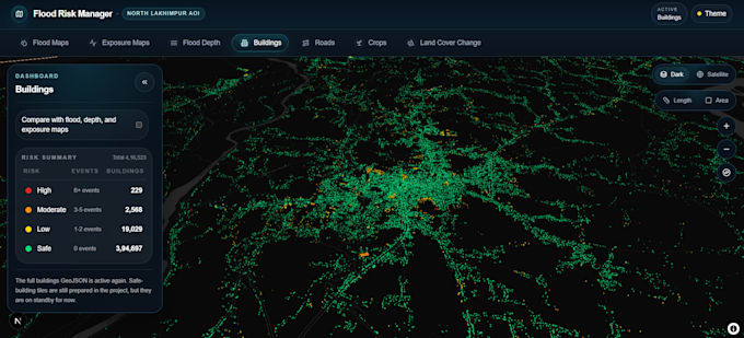
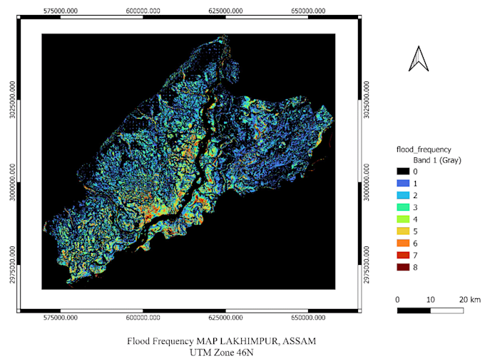
I provide professional GIS, remote sensing, and WebGIS services for projects involving spatial data processing, thematic mapping, flood analysis, land use and exposure assessment, and interactive geospatial dashboards. My work includes handling raster and vector datasets, organizing multi layer map interfaces, and developing web-based geospatial platforms for analysis and visualization.
I also support cloud based geospatial workflows using AWS, Docker, FastAPI, TiTiler, Next.js, MapLibre, and deck.gl for scalable and deployment-ready WebGIS solutions.
MTech in Geospatial Engineering IIT Roorkee
Talen
How many years of experience you have with geospatial data?
I have 4+ years of practical experience working with geospatial data in GIS, remote sensing, flood analysis, spatial processing, and WebGIS application development.
Do you provide cloud-based deployment support?
Yes, I can support deployment oriented geospatial workflows using AWS, Docker, FastAPI, TiTiler, GeoServer and modern WebGIS stacks.
Can you customize the project based on my requirements?
Yes, every project can be customized based on your study area, data availability, analysis needs, and preferred outputs.
What do you need from me to start?
Please share your project goal, study area, available data, required outputs, and any preferred tools or formats.