GIS Analyst and Geologist, ArcGIS ENVI Drone Photogrammetry
Bolivia
Spaans, Engels
Sommige informatie wordt in het Engels weergegeven.
Over mij
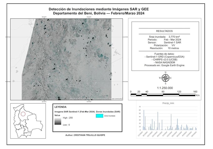
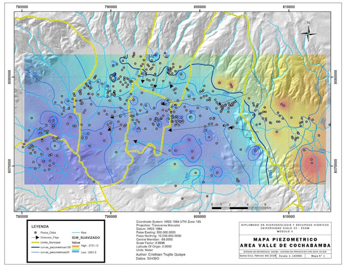
I'm a geologist and GIS specialist with 5+ years of experience in spatial data processing, geological mapping, and drone photogrammetry. I've worked as a technical consultant for SERGEOMIN (Bolivia's national geological survey), generating official cartography and processing geospatial data for mining and geology projects.
I deliver: thematic and geological maps (ArcGIS/QGIS), satellite image classification (ENVI/GEE), drone photogrammetry outputs (ortho + DTM), hydrogeological analysis, and technical reports.
Fast delivery. Technically precise. Clear communication.... Lees meer