Door categorieën bladeren
Ontdekken
Fiverr Pro
Nederlands
$
USD

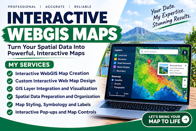
Need an interactive map that makes your location data clear and easy to explore?
MY SERVICES
WHAT YOU WILL RECEIVE
WHY CHOOSE ME
Ready to bring your spatial data to life? Click Continue to order, or message me with your goal, data format, study area, and a preferred example. Ill review the scope and recommend the right package before we begin.
Please note: advanced dashboards, custom-coded apps, live API connections, extensive data cleaning, and account or licensing costs are excluded unless agreed in advance.
GIS ANALYST AND WEBGIS DEVELOPER
Talen
What do you need from me to start?
Please provide your project goal, study area, data files, desired map features, preferred style, and any reference map you like.
Which data formats can you accept?
Depending on the project, I can assess CSV, Excel, GeoJSON, KML, zipped Shapefiles, and compatible existing GIS data. Please message me first about unsupported or complex files.
Can you prepare or clean my GIS data?
Basic organization of supplied data may be included where agreed. Extensive cleaning, data sourcing, conversion, and complicated geometry repairs require scope review and may cost extra.
Can you add layers, pop-ups, labels, and legends?
Yes, where supported by the chosen platform and included in your selected package. The number of layers and exact features will be agreed before work begins.
Can you customize an existing web map?
Yes, I can review an existing map and discuss suitable changes. Please share its link, screenshots, or relevant files and explain what you want improved.
Will you publish the map to my website?
Website embedding or custom website integration is not included by default. Share your platform and requirements so I can assess the work and provide a suitable offer.
Can you create dashboards or ArcGIS StoryMaps?
These are separate, more specialized deliverables. Please describe the required features first so I can confirm the scope, platform, price, and delivery time.
What will I receive when the project is complete?
You will receive the agreed map link and any project files or handover notes included in your package. Source code is not included unless explicitly agreed.
Are revisions included?
Yes. Each package includes the stated number of revisions for changes within the original agreed scope. New features or substantial changes may require an additional offer.
Should I contact you before ordering?
Please contact me first for complex projects, multiple datasets, advanced functionality, custom integrations, or uncertain data formats. I will help define a suitable scope before work starts.