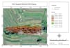
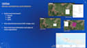
Ik maak professionele gis-kaarten en geospatiale data visualisaties

D
dapidddd
D
dapidddd
David B
Sommige informatie is automatisch vertaald.

Over deze dienst

Automatische vertaling

Ik maak professionele GIS-kaarten, voer ruimtelijke analyses uit en visualiseer geospatiale data met ArcGIS, QGIS en andere GIS-tools. Ik kan je helpen geografische data om te zetten in duidelijke, nauwkeurige en visueel aantrekkelijke kaarten voor jouw projecten.

Maak kennis met David B

David B

Senior Staff Operational

  • Afkomstig uitIndonesië
  • Lid sindsmrt 2026
  • Gem. reactietijd1 uur
  • Talen

    Indonesisch, Engels
Master’s degree in Geomatic Engineering (ITS) with strong specialization in GIS and Remote Sensing Research and technical expertise in machine learning for geospatial analysis (XGBoost) Over four years of experience in GIS applications for infrastructure and environmental projects Advanced proficiency in ArcGIS, QGIS, geodatabase management, and spatial analysis tools Strong background in topographic surveying, data processing, and engineering integration A proven ability to collaborate with multidisciplinary teams and government institutions

Automatische vertaling

Mijn portfolio

Gerelateerde tags