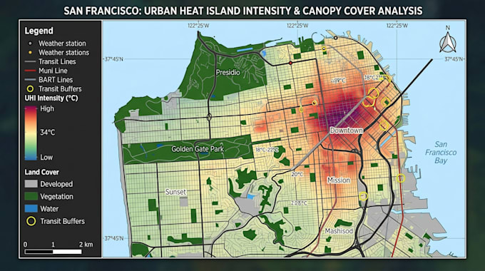
Ik maak aangepaste gis-kaarten, ruimtelijke analyse en data visualisatie

D
david_john62
D
david_john62
David John
Sommige informatie is automatisch vertaald.

Over deze dienst

Automatische vertaling

Hallo en welkom!

Ben je op zoek naar professionele GIS-kaarten, ruimtelijke analyse of geospatiale data visualisatie? Je bent op de juiste plek.

Ik maak nauwkeurige, hoogwaardige GIS-kaarten op maat voor bedrijven, onderzoekers, overheidsinstanties, vastgoed, milieustudies, stedelijke planning en meer. Met ArcGIS, QGIS en andere industry standard tools zet ik geografische data om in duidelijke, visueel aantrekkelijke kaarten die betere planning en besluitvorming ondersteunen.


De diensten omvatten:

  • Aangepaste GIS-kaarten
  • Ruimtelijke analyse
  • Heatmaps
  • Thematische en choroplethkaarten
  • Buffer- en overlay-analyse
  • Landgebruik- en zoningkaarten
  • Verkoopgebiedkaarten
  • Milieu- en infrastructuurkaarten
  • Interactieve kaarten
  • Data visualisatie
  • Georeferentie en coördinatenconversie


Waarom voor mij kiezen?

  • Professionele kwaliteit kaarten
  • Nauwkeurige GIS-analyse
  • Schoon cartografisch ontwerp
  • Snelle levering
  • Hoge resolutie output
  • Veranderbare bronbestanden
  • Uitstekende communicatie

Bestel nu en laten we je geografische data omzetten in krachtige visuele inzichten.

Maak kennis met David John

David John

Custom Map Illustrator

  • Afkomstig uitVerenigd Koninkrijk
  • Lid sindsjul 2026
  • Talen

    Engels
Hi, I'm David John, a professional Map Illustrator with a passion for transforming locations into beautiful, easy-to-understand visual maps. I specialize in creating custom illustrated maps for tourism, real estate, resorts, hotels, theme parks, events, campuses, businesses, property developments, and websites. Every map I create is designed to be visually appealing, informative, and tailored to your specific needs. I focus on delivering clean, accurate, and high-quality artwork using industry-standard software such as Adobe Illustrator, Photoshop, AutoCAD, and GIS tools where required.

Automatische vertaling