Door categorieën bladeren
Ontdekken
Fiverr Pro
Nederlands
$
USD


Automatische vertaling
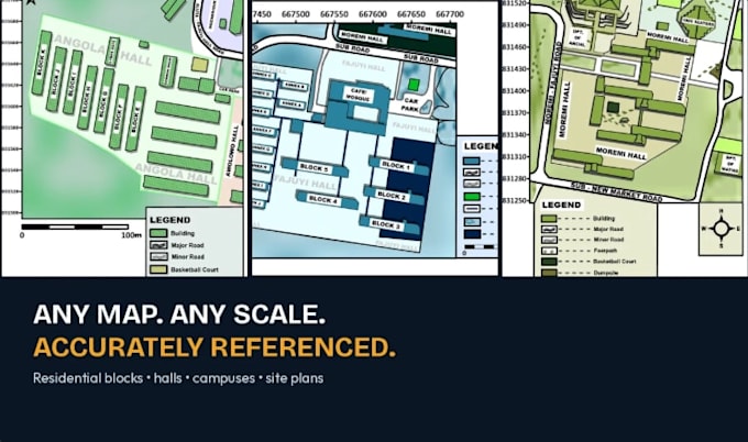
Ik georeferenceer gescande of rasterkaarten naar nauwkeurige coördinatensystemen met Golden Software Surfer. Je krijgt een schone, exporteerbare basiskaart die klaar is om in je rapport, GIS-project of voorstel te worden gebruikt, met correcte ruimtelijke referentie waarop je kunt vertrouwen.
Tags: georeferentie, GIS, coördinatensysteem, ruimtelijke mapping, cartografie, Golden Surfer Software
Bold ideas, brilliant results
Talen
Automatische vertaling
Automatische vertaling
Welke bestandsformaten accepteer je voor de bronkaart / afbeelding?
JPG, PNG, TIFF of PDF scans. Hogere resolutie geeft nauwkeurigere resultaten.
Met welke coördinatensystemen kan je werken?
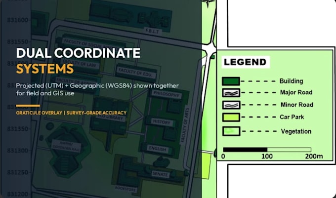
Ik kan georeferentieer naar WGS84, UTM of jouw opgegeven geprojecteerde coördinatensysteem. Als nodig, kan ik ook dual coördinatensystemen (geprojecteerd + WGS84) op één kaart tonen.
Moet ik referentiepunten aanleveren, of kan je ze vinden?
Als je kaart zichtbare herkenningspunten, wegen of bekende coördinaten heeft, kan ik die gebruiken. Zo niet, geef dan minimaal 3-4 referentiepunten met bekende coördinaten voor nauwkeurigheid.
Welke software gebruik je?
Golden Software Surfer, voor precieze, professionele output.
Kun je kaarten zonder duidelijke referentiepunten aan?
Dit is moeilijker en kan de nauwkeurigheid beïnvloeden — stuur me eerst je bestand zodat ik de haalbaarheid kan bevestigen voordat je bestelt.