Door categorieën bladeren
Nederlands
$
USD
Koppel je AI aan Fiverr


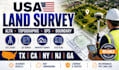
Need accurate and professional land survey services for a USA property or development project?
I provide land surveying and CAD drafting services for residential, commercial, and construction projects, including:
The deliverables can include clear CAD drawings, property boundaries, dimensions, elevations, existing improvements, structures, utilities, easements, contours, and other required survey information based on the project scope.
Whether you need a property survey, boundary survey, ALTA survey, topographic survey, site survey, or survey CAD drafting, the work is prepared with attention to detail and professional presentation.
Send your project details, location, existing files, and requirements before ordering so the scope and deliverables can be confirmed.
Laat het de freelancer weten als je voorkeuren voor of zorgen hebt over het gebruik van AI-tools voor het voltooien en/of leveren van je bestelling.
Senior Land Surveyor and Project Manager
Talen
