Ik maak een web gis kaart interactieve kaart en app met leaflet mapbox gi js google maps

D
dorlythem
D
dorlythem
Chiemerie
Sommige informatie is automatisch vertaald.

Over deze dienst

Automatische vertaling

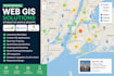
Ik maak professionele Web GIS kaarten, interactieve kaarten en geospatiale webapplicaties met Leaflet, Mapbox GL JS en Google Maps API.


Ik ben gespecialiseerd in het bouwen van high-performance, schaalbare en responsieve mapping oplossingen die je helpen om geospatiale data in realtime te visualiseren, analyseren en ermee te interactieëren.


 Wat ik aanbied

  • Web GIS ontwikkeling vanaf nul
  • Interactieve kaarten met Leaflet, Mapbox of Google Maps
  • Aangepaste kaartapplicaties en dashboards
  • Geospatiale data visualisatiesystemen
  • Locatiegebaseerde diensten (LBS) applicaties
  • Realtime GPS-tracking systemen
  • Heatmap visualisatie en clustering
  • Routeplanning en navigatiesystemen
  • Kaartlagen integratie (markers, polygonen, lijnen)
  • Ruimtelijke data verwerking en analyse
  • API-integratie (Google Maps API, Mapbox API)
  • Oplossingen gebaseerd op OpenStreetMap
  • Database-integratie (PostgreSQL/PostGIS, MySQL, Firebase)
  • Responsief map UI/UX ontwerp voor alle apparaten
  • Web mapping applicaties met JavaScript, React, Node.js of Python


Technologieën die ik gebruik

Leaflet JS Mapbox GL JS Google Maps API OpenStreetMap JavaScript React.js Node.js Python Django FastAPI PostGIS GeoJSON


Stuur me een bericht voorafgaand aan de bestelling

Maak kennis met Chiemerie

Chiemerie

Web GIS Developer Mapbox Leaflet Openstreetmap Interactive map app

  • Afkomstig uitVerenigde Staten
  • Lid sindsjun 2026
  • Talen

    Engels, Duits, Arabisch
I specialize in Web GIS development, interactive mapping solutions, and cross-platform mobile app development. With expertise in Mapbox, Leaflet, OpenStreetMap, Google Maps, Esri, Bing Maps, Flutter, React Native, Kotlin, and Swift, I build scalable web and mobile applications with seamless API integration. My services include 3D web maps, geospatial visualization, location-based services, custom dashboards, navigation systems, GIS analysis, and performance optimization for Android and iOS applications.

Automatische vertaling