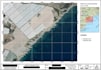
Ik maak professionele kaarten met QGIS of ArcGIS

E
edu_bel
E
edu_bel
Eduardo B
Sommige informatie is automatisch vertaald.

Over deze dienst

Automatische vertaling

Heb je een professionele GIS-kaart nodig voor je project?

Ik ben een GIS-specialist met ervaring in QGIS, ArcGIS en ruimte-analyse. Ik maak nauwkeurige, hoogwaardige kaarten voor bedrijven, onderzoekers, ingenieurs, milieuconsulenten en overheidsorganisaties.

Ik kan je helpen met:

Professionele GIS-kaarten

Cartografisch kaartontwerp

QGIS & ArcGIS-projecten

Visualisatie van ruimtelijke data

Shapefile, KML, KMZ & GeoJSON verwerking

Georefereren van kaarten en satellietbeelden

Thematische kaarten (landgebruik, milieu, landbouw, etc.)

Kaarten in hoge resolutie voor rapporten en presentaties

Wat je ontvangt:

  • Professionele en nauwkeurige kaarten
  • Hoge resolutie PDF, PNG of JPEG
  • Bronbestanden (indien inbegrepen in je pakket)
  • Snelle communicatie
  • Op tijd leveren

Neem contact met mij op voordat je een bestelling plaatst als je project complex is of een aangepaste GIS-analyse vereist.

Ik kijk ernaar uit om je te helpen met je GIS-project!

Maak kennis met Eduardo B

Eduardo B

GIS Expert

  • Afkomstig uitSpanje
  • Lid sindsjul 2026
  • Gem. reactietijd1 uur
  • Talen

    Spaans, Engels
I am a GIS specialist with more than 8 years of experience delivering spatial analysis, cartography, land suitability studies and technical GIS solutions. I can help you with: ✔ QGIS and ArcGIS projects ✔ Spatial data analysis ✔ Interactive maps ✔ Cartography ✔ Land suitability studies ✔ Georeferencing ✔ Shapefile and GeoJSON processing ✔ Technical reports I have worked on projects for public institutions and private companies, delivering accurate, professional and reliable GIS solutions. I focus on clear communication, fast delivery and high-quality results.

Automatische vertaling

Mijn portfolio