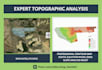
Ik maak topografische analyse, civil 3d, gis

E
engr_hamidul
E
engr_hamidul
Hamidul I
Sommige informatie is automatisch vertaald.

Over deze dienst

Automatische vertaling

Ik ben gespecialiseerd in het verwerken van satellietgegevens, LiDAR en meetpunten om te leveren:

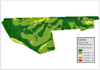
  • Gedetailleerde contourkaarten: Precisie-intervallen (0,5 m, 1 m, 5 m) voor locatieplanning.
  • Digitale hoogtemodellen (DEM/DTM/DSM): Hoogwaardige oppervlakte- en terreinmodellering.
  • Hellings- en aspectanalyse: Essentieel voor drainage en bouwmogelijkheden.
  • Hydrologische analyse: Waterscheidingsafbakening en stroomrichtingmapping.
  • 3D-terreinvizualisatie: Realistische 3D-weergaven van jouw locatie.

Waarom voor mij kiezen?

  • Software expertise: Ik ben bedreven in ArcGIS Pro, QGIS en AutoCAD Civil 3D.
  • Nauwkeurigheid: Ik zorg dat alle data correct georeferentieerd en geprojecteerd is.
  • Snelle levering: Kwaliteitsresultaten met snelle doorlooptijden.
  • Aangepaste formaten: Ik lever bestanden in PDF, DWG, SHP, TIFF of KMZ.

Wat ik van jou nodig heb Geef de locatie van de site door (coördinaten of KML-bestand) of je ruwe meetgegevens (CSV/TXT/LAS).

Maak kennis met Hamidul I

Hamidul I

Civil Engineer

  • Afkomstig uitBangladesh
  • Lid sindsokt 2025
  • Gem. reactietijd1 uur
  • Talen

    Bengaals, Engels, Frans
With over 18 years of professional experience in Civil Engineering, I provide high-end technical solutions ranging from intricate structural analysis to working drawing for construction. My career has been built on a foundation of safety, accuracy, and aesthetic functionality. Whether you need a residential floor plan, a complex structural calculation for a multi-story building, or spatial data analysis via GIS, I bring nearly two decades of industry-standard expertise to every project. I am proficient in AutoCAD, Revit, ETABS, GIS and XL to bring precision in your project. Let's hear from you

Automatische vertaling

Mijn portfolio