Door categorieën bladeren
Ontdekken
Fiverr Pro
Nederlands
$
USD

Topographic Survey Manager
Skills
Bekijk mijn diensten
BIM | Topographic Survey Manager
Bimflo. • Fulltime
Jun 2023 - Present • 3 yrs
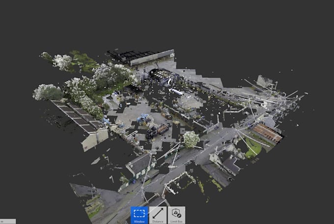
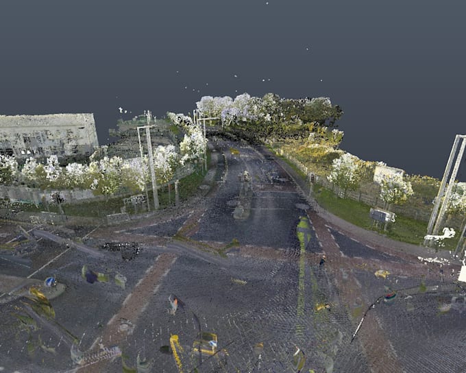
I am a BIM and Topographic Survey Manager at Bimflo, with extensive experience delivering Scan to BIM, point cloud processing, and topographic survey solutions for architectural, engineering, and construction projects. I manage and deliver high-accuracy BIM models derived from laser scan and survey data, ensuring alignment with real-world conditions and project standards. My expertise covers the full workflow—from field survey coordination and point cloud registration to Revit-based BIM modeling and final project deliverables. Core Expertise 🔹 Scan to BIM (Point Cloud to Revit) 🔹 BIM Modeling – Architectural, Structural & MEP 🔹 Topographic & Land Survey Management 🔹 Laser Scanning (LiDAR) Data Processing 🔹 As-Built BIM Models 🔹 LOD 200 / 300 / 400 🔹 Autodesk Revit, AutoCAD, Navisworks, Recap 🔹 IFC & Construction Documentation What I Deliver ✔ Accurate as-built BIM models from point cloud data ✔ Survey-based BIM aligned with topographic and geospatial data ✔ Clean, clash-free Revit models ready for construction and coordination ✔ Reliable outputs for renovation, retrofit, and infrastructure projects ✔ On-time delivery with professional communication Why Work With Me ⭐ Manager-level experience in BIM & survey coordination ⭐ Strong understanding of both field data and BIM workflows ⭐ Proven ability to deliver complex Scan to BIM projects ⭐ Detail-oriented approach with strict quality control ⭐ Backed by professional expertise at Bimflo Industries Served 🏗 Architecture & Construction 🏢 Commercial & Residential Buildings 🏭 Industrial Facilities 🛣 Infrastructure & Topographic Projects 🏛 Renovation & Heritage Buildings
BIM Engineer
DAC (Dot Architecture Consultant) • Fulltime
Aug 2021 - Jun 2023 • 1 yr 10 mos
I specialize in Scan to BIM services, converting laser scan point clouds into accurate, intelligent Revit BIM models for architectural, structural, and MEP purposes.
BIM Engineer
China Civil Engineering Construction Corporation (CCECC) • Fulltime
Feb 2018 - Jan 2021 • 2 yrs 11 mos
I manage and deliver high-accuracy BIM models derived from laser scan and survey data, ensuring alignment with real-world conditions and project standards. My expertise covers the full workflow—from field survey coordination and point cloud registration to Revit-based BIM modeling and final project deliverables.
