Door categorieën bladeren
Ontdekken
Fiverr Pro
Nederlands
$
USD


Automatische vertaling
Een slecht ontworpen kaart kan stakeholders afleiden. Of het nu gaat om een subsidieaanvraag, onderzoeksrapport of milieurapport, je hebt schone, publicatieklare cartografie nodig.
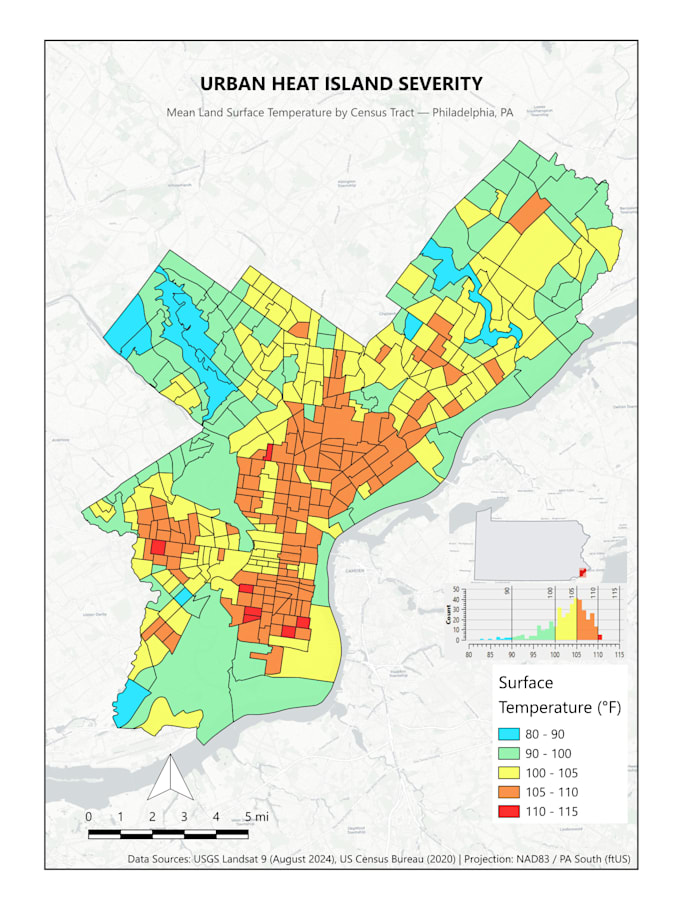
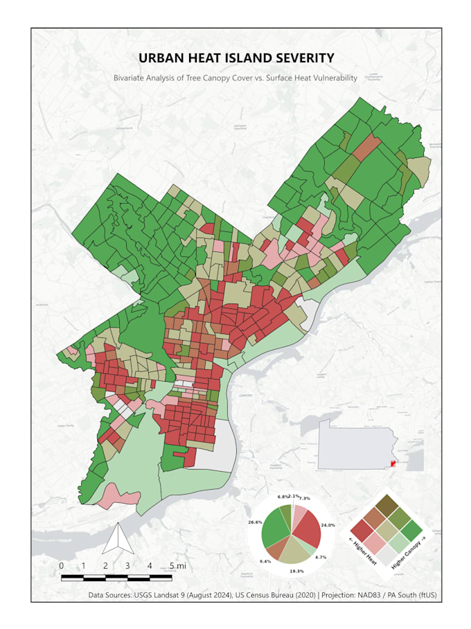
Met QGIS transformeer ik je ruimtelijke datasets of haal ik open overheids- en Census-gegevens voor je in visueel opvallende, nauwkeurige kaarten met gebalanceerde lay-outs en precieze symbologie.
Wat ik Kan Creëren:
Wat Je Ontvangt:
Stuur me gerust een bericht voordat je bestelt om de scope van je project en databehoeften te bevestigen!
GIS Analyst: QGIS, Python, Spatial Data Analysis
Talen
Automatische vertaling
Automatische vertaling
Wat betekent het vakje "Presentatieslides"?
Het betekent dat je uiteindelijke kaarten worden geëxporteerd in een 16:9 beeldverhouding in hoge resolutie (300 DPI), perfect formaat om direct in PowerPoint of Google Slides te plaatsen zonder vervelende bijsnijdingen. Ik lever de kaartgrafieken, niet het volledige presentatieontwerp.
Lever je de QGIS bronbestanden aan?
Ja! De verpakte QGIS bronbestanden (.qgz) zijn automatisch inbegrepen bij het Premium pakket. Als je het Basic of Standaard pakket koopt, kun je bronbestanden als Gig Extra toevoegen bij het afrekenen.
Kun je mijn specifieke merk kleuren of journalrichtlijnen matchen?
Absoluut. Geef gewoon je merk hex-codes, een stijlgids of de specifieke opmaakvereisten van je doelpublicatie door, en ik pas de typografie en kleurverlopen van de kaart aan zodat ze perfect matchen.
Wat moet ik aanleveren om aan de slag te gaan?
Zo ja, voeg ze toe! Zo niet, beschrijf je doelgebied en de metrics die je nodig hebt. Ik kan standaard, publiek beschikbare datasets ophalen (zoals US Census demografie of open gemeentelijke data) voor jouw project.