Door categorieën bladeren
Nederlands
$
USD
Koppel je AI aan Fiverr


Automatische vertaling
Heb je een nieuwe Google Earth Engine-workflow nodig of hulp bij het oplossen van een script dat fouten, time-outs of onjuiste uitvoer geeft?
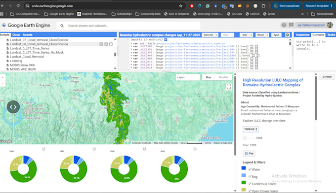
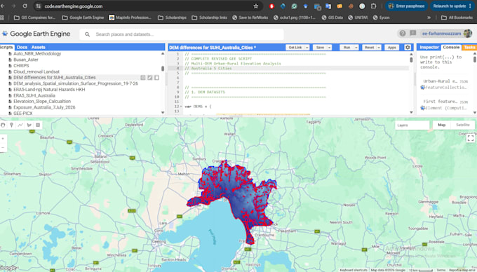
Ik ontwikkel, verbind en optimaliseer Google Earth Engine-scripts voor satelliet- en milieu-analyses.
Diensten omvatten:
ImageCollection-filtering en preprocessing
Cloud- en schaduwmaskering
Landsat, Sentinel, MODIS, ERA5, CHIRPS en aanverwante datasets
Spectrale indexberekeningen
Classificatie en veranderingsdetectie
Tijdreeksextractie en trendanalyse
Zonaal en regionaal statistieken
Multi-date en multi-regio verwerking
Kaartlegenda’s, grafieken en interface-componenten
Google Drive- en Asset-export
Optimalisatie van geheugenlimiet en time-out
Herbruikbare functies en commentaar in de code
Stuur je script, studiegebied, dataset, foutmelding, gewenste uitvoer en projectdoel voordat je bestelt.
Elk pakket heeft een afgebakende scope. Een nieuw dataset, analytische methode, interface of studiegebied kan extra of maatwerk vereisen.
Researcher, Problem Solver
Talen
Automatische vertaling
Automatische vertaling
Kun je geheugenlimiet- of time-outfouten oplossen?
Meestal wel. Oplossingen kunnen zijn: herstructureren van server-side bewerkingen, wijzigen van schaal, regionen opdelen in tegels, onnodige conversies beperken of exportmethoden herzien.
Moet ik een bestaande script leveren?
Een bestaand script is vereist voor het Basic debugging-pakket. Standaard en Premium kunnen een nieuw workflow bevatten die is ontwikkeld op basis van het afgesproken doel.
Kunt u de code uitleggen?
Alle pakketten bevatten commentaar. Gedetailleerde technische documentatie is inbegrepen in Premium of kan als extra worden gekocht.
Kun je toegang krijgen tot mijn private Earth Engine-assets?
Je moet de benodigde assets delen met de juiste permissies. Verzamel nooit wachtwoorden, herstelcodes of accountgegevens.
Kun je een Google Earth Engine-applicatie bouwen?
Eenvoudige interface-componenten kunnen worden opgenomen. Een complete interactieve applicatie, dashboard of openbare app vereist een maatwerk-offer.
Kun je exporteren automatiseren?
Ja. Geautomatiseerde multi-date, multi-regio en multi-variabele exportfuncties zijn beschikbaar via Premium of de batch-export-extra.
Welke taal zal de code gebruiken?
Google Earth Engine JavaScript is de standaard. Python-gebaseerde Earth Engine-workflows vereisen tevoren overleg en een maatwerkafspraak.
Wat wordt niet als een herziening beschouwd?
Het vervangen van de dataset, het wijzigen van het onderzoeksdoel, het toevoegen van een studiegebied of het vragen om een andere analysemethode is nieuw werk en geen revisie.