Door categorieën bladeren
Ontdekken
Fiverr Pro
Nederlands
$
USD

Level 1


Automatische vertaling
Ik ben een Geospatial Engineer (MSc) met meer dan 20 jaar ervaring in het maken van Digital Elevation Models, Contour Maps, GIS-oplossingen, LiDAR en landmeting. Ik help ingenieurs, consultants, onderzoekers en landontwikkelaars om ruwe hoogtegegevens om te zetten in nauwkeurige, beslissingsklare oppervlaktemodellen.
Deze dienst omvat:
Hoofdleveringen
Extra diensten
Ik lever in het bestandsformaat en de resolutie die bij jouw software passen. Vertel me gewoon welk programma je gebruikt en ik pas de bestanden daarop aan.
Tools die ik gebruik: ArcGIS Pro, QGIS, Google Earth, Global Mapper, Pix4D, Metashape, AutoCAD Civil 3D
Vertrouwd door tevreden klanten wereldwijd.
Stuur me een bericht met je data bron en projectgebied (adres, coördinaten of Google Maps pin), en ik bevestig de scope, deliverables en doorlooptijd voordat je bestelt.
GIS Mapping, Drone Surveying, CAD Site Plans, 3D Modeling and Animations
Level 1
Talen
Automatische vertaling
Automatische vertaling
Wat is een Digital Elevation Model (DEM)?
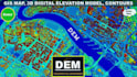
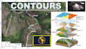
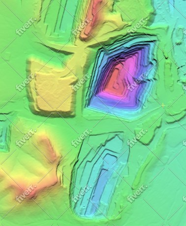
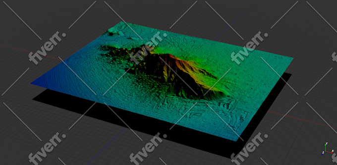
Een Digital Elevation Model (DEM) is een 3D computer graphics representatie van hoogtegegevens om terrein te visualiseren. DEM is een raster GIS-laag met raster grids van het aardoppervlak, refererend aan het verticale referentievlak (Zero Elevation).
Wat zijn contourlijnen en topografische kaarten?
Simpel gezegd markeren hoogtelijnen punten van gelijke hoogte op een kaart. Topografie is de studie van geografische kenmerken in een landschap. Een kaart met hoogtelijnen wordt een topografische kaart genoemd. Topografische kaarten geven in wezen het driedimensionale landschap van de aarde weer binnen de 2D-ruimte van een kaart.
Welke gegevens heb je nodig om een DEM en contourkaart te maken?
Om een DEM en contourkaart te maken, heb ik meestal hoogtegegevens nodig uit bronnen zoals landmeting topo of grondmetingen (GNSS, DGPS, Total Station, Laser Scanner, LiDAR), stereobeelden uit fotogrammetrie (satellietbeelden, luchtfoto's), SAR, radar datasets of topografische bladen.
Kun je de contourintervallen en kaart specificaties aanpassen aan mijn wensen?
Absoluut! Ik begrijp dat verschillende projecten unieke eisen kunnen hebben. Of je nu specifieke contourintervallen, kaartafmetingen, coördinatensystemen of andere specificaties nodig hebt, ik pas de opleveringen aan om aan jouw exacte wensen te voldoen.
Voor welke projecten kunnen jouw diensten voordeel bieden?
Mijn diensten zijn ideaal voor een breed scala aan projecten, waaronder landontwikkeling, engineering ontwerp, waterscheidingsmodellering, locatieplanning, klimaatanalyses en meer. Of je nu een ingenieursbureau of een milieukundig adviseur bent, ik kan je helpen met je GIS contour mapping en DEM behoeften.
Wat zijn de uitgebreide toepassingen van Digital Elevation Models?
- Geografische informatiesystemen / GIS mapping - Landmeting & topo contouren - 3D visualisatie - Civiele techniek - Hydrologie / hydrologische modellering - Overstromingsmodellen en mapping - Wegenbouw / milieutechniek / waterresource engineering - Telecom en nutsvoorzieningen
Welke software gebruik je voor het ontwikkelen van DEMs en contourkaarten?
Ik ben gespecialiseerd in het gebruik van ArcGIS Pro, een professionele GIS-software, voor het ontwikkelen van hoogwaardige DEMs en contourkaarten. ArcGIS Pro biedt geavanceerde mogelijkheden voor terrein analyse en visualisatie, wat zorgt voor nauwkeurige en gedetailleerde resultaten.
Wat is de gebruikelijke doorlooptijd voor het leveren van het eindproduct?
De doorlooptijd kan variëren afhankelijk van de complexiteit en scope van het project. Na overleg over je wensen, geef ik je een geschatte levertijd. Ik streef ernaar om hoogwaardige resultaten op tijd te leveren om aan je projectdeadlines te voldoen.
Bied je revisies aan als ik niet tevreden ben met de eerste opleveringen?
Ja, klanttevredenheid staat voorop. Ik bied revisies aan om te zorgen dat de uiteindelijke opleveringen aan je verwachtingen en projectvereisten voldoen.
| (15) | ||
| (1) | ||
| (0) | ||
| (0) | ||
| (0) |
bleblanc03

Verenigde Staten
Great to work with. Delivered nice assets for my project. I would not hesitate to reach out again if/when I need more work at this level.
US$ 400-US$ 600
Prijs
3 weken geleden
Looptijd
jebjeb2000
Verenigde Staten
I needed a model of a mountain for architectural rendering. Geospatial provided a highly detailed file that was actually far too large for my program to handle. Geospatial followed up with several options of smaller size, and I was able to use the edits. They were communicative in adjusting the parameters to fit what I needed. Thank you!
US$ 200-US$ 400
Prijs
2 weken geleden
Looptijd

Reactie van de freelancer
ricmed372
Verenigde Staten
Thank you. I appreciate the work
US$ 100-US$ 200
Prijs
5 dagen
Looptijd

jasonwarner845

Costa Rica
This is my third order with Geospatial. Always high quality, timely, and visually appealing.
US$ 50
Prijs
1 dag
Looptijd
jasonwarner845
Costa Rica
This is my second project with Geospatial Engr. I found them after an underwhelming experience with another provider. Very pleased with the technical capabilities and professional way they presented the data. When the need arises, I would be happy to work with Geospatial again.
US$ 100-US$ 200
Prijs
8 dagen
Looptijd
| (15) | ||
| (1) | ||
| (0) | ||
| (0) | ||
| (0) |
bleblanc03
Verenigde Staten
Great to work with. Delivered nice assets for my project. I would not hesitate to reach out again if/when I need more work at this level.
US$ 400-US$ 600
Prijs
3 weken geleden
Looptijd
jebjeb2000
Verenigde Staten
I needed a model of a mountain for architectural rendering. Geospatial provided a highly detailed file that was actually far too large for my program to handle. Geospatial followed up with several options of smaller size, and I was able to use the edits. They were communicative in adjusting the parameters to fit what I needed. Thank you!
US$ 200-US$ 400
Prijs
2 weken geleden
Looptijd
Reactie van de freelancer
ricmed372
Verenigde Staten
Thank you. I appreciate the work
US$ 100-US$ 200
Prijs
5 dagen
Looptijd
jasonwarner845
Costa Rica
This is my third order with Geospatial. Always high quality, timely, and visually appealing.
US$ 50
Prijs
1 dag
Looptijd
jasonwarner845
Costa Rica
This is my second project with Geospatial Engr. I found them after an underwhelming experience with another provider. Very pleased with the technical capabilities and professional way they presented the data. When the need arises, I would be happy to work with Geospatial again.
US$ 100-US$ 200
Prijs
8 dagen
Looptijd