Door categorieën bladeren
Ontdekken
Fiverr Pro
Nederlands
$
USD

Automatische vertaling
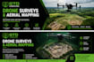
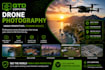
Ik bied hoogwaardige, betrouwbare drone survey diensten op maat van jouw projectbehoeften. Ik vast accurate luchtgegevens voor een breed scala aan toepassingen, waaronder landmeting, bouwmonitoring, vastgoed, landbouw, dakinspecties en locatie-inspecties, evenals luchtfotografie.
Met een sterke focus op precisie en efficiëntie lever ik gedetailleerde high-resolution beelden om je te helpen weloverwogen beslissingen te nemen. Of je nu voortgangscontrole op een bouwplaats nodig hebt of een volledige luchtmeting van grote landgebieden, ik zorg voor snelle doorlooptijden en professionele resultaten.
Veiligheid, naleving en datanauwkeurigheid staan bij mij voorop. Elk project wordt zorgvuldig gepland en met aandacht voor detail uitgevoerd, zodat je betrouwbare en bruikbare inzichten krijgt.
Laten we samenwerken om een nieuw perspectief aan jouw project van bovenaf te geven.
Cork (Alleen Munster regio)
IT Support
Talen
Automatische vertaling


