Door categorieën bladeren
Ontdekken
Fiverr Pro
Nederlands
$
USD
GIS-ontwikkelaar, remote sensing wetenschapper
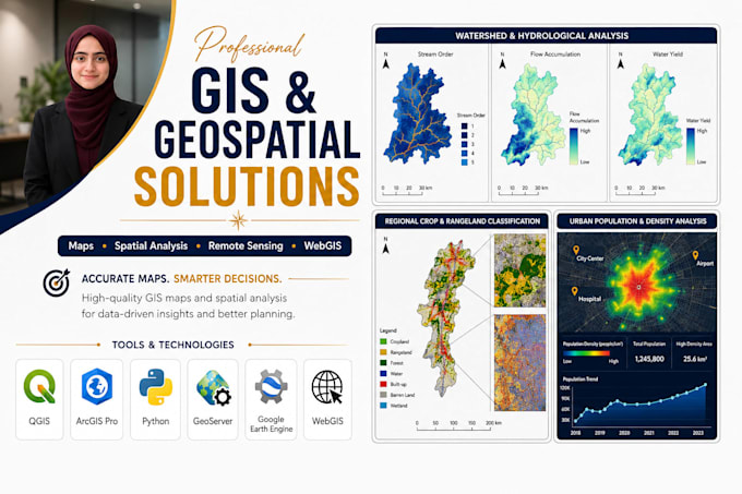
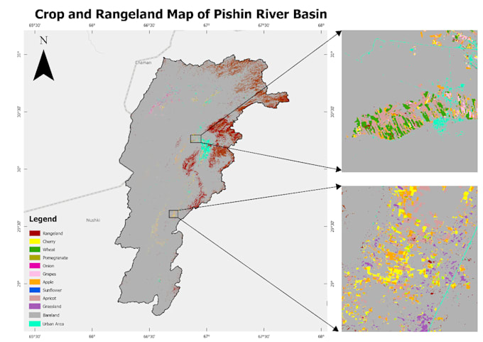
Hoi! Ik ben een GIS & Remote Sensing specialist die onderzoekers, bedrijven en organisaties helpt om geospatiale data om te zetten in nauwkeurige kaarten, inzichten en slimme oplossingen.
Mijn diensten:
Tools: ArcGIS Pro | QGIS | Google Earth Engine | Python | PostGIS | PostgreSQL | GeoServer | Leaflet | Mapbox | TensorFlow | PyTorch
Ik lever nauwkeurige, professionele en praktische geospatiale oplossingen die op maat gemaakt zijn voor jouw projectbehoeften.

Programmeertaal:
Python
Technologie:
Jupyter-notitieboek
•
MATLAB
•
ArcGIS
Type analyse:
Kwalitatieve analyse
•
statistische analyse
Tools:
Microsoft Excel
Automatische vertaling
Met welke satellietdatasets kun je werken?
Sentinel-1 (SAR), Sentinel-2 (optisch), Sentinel-5P / TROPOMI (luchtkwaliteit), Landsat 5/7/8/9, MODIS, SRTM / ASTER DEM, GPM neerslag, en vrijwel elk dataset dat toegankelijk is via Google Earth Engine.
Kun je werken met mijn eigen data — shapefiles, rasters, CSV?
Ja. Ik accepteer Shapefile, GeoPackage, GeoJSON, KML/KMZ, GeoTIFF, en CSV/Excel met coördinaten. Ik verwerk ook rommelige, inconsistente of slecht geprojecteerde data als een routine onderdeel van het werk.
Lever je de broncode op?
Altijd — in de Standard en Premium pakketten. Elke script is volledig gecommentarieerd en gedocumenteerd met een README. Jij bezit de code en kunt deze zelfstandig aanpassen of opnieuw uitvoeren.
Kunnen de outputs worden gebruikt in academische publicaties?
Ja. Mijn pipelines volgen peer-reviewed methodologieën: harmonische regressie, Mann-Kendall, Random Forest met confusion-matrix nauwkeurigheidsbeoordeling. Figuren kunnen op verzoek worden geformatteerd volgens MDPI, Elsevier, Springer of IEEE standaarden.
Welke studiegebiedgroottes kun je aan?
Van een enkel landbouwveld tot een heel land. Ik gebruik getilde verwerking en GEE's cloud infrastructuur voor grote gebieden. Projecten op nationale schaal zijn routine.
Kan ik iets aanvragen dat niet hierboven staat?
Stuur me eerst een bericht en ik bepaal de scope en maak een op maat gemaakte aanbieding. Als het gaat om GIS, remote sensing of ruimtelijke data, kan ik bijna zeker helpen.