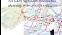
Ik maak aangepaste GIS-kaarten, webkaarten en georuimtelijke analyses met ArcGIS en QGIS.

H
harris__meizu
H
harris__meizu
harris Meizu
Sommige informatie is automatisch vertaald.

Over deze dienst

Automatische vertaling

Ik bied professionele GIS mapping, georeferentie en ruimtelijke analyse diensten voor milieuprojecten, engineering, planning, landbouw en onderzoek. Elke oplossing wordt op maat gemaakt volgens jouw projectvereisten met behulp van industry-standard GIS tools.

Diensten

  • Thematische en topografische kaarten
  • Op maat gemaakte kaartontwerp en visualisatie
  • 3D-terreinemodellering
  • Ruimtelijke analyse en interpolatie
  • Geschiktheidsanalyse voor land
  • Netwerk- en routeanalyse
  • Satelliet- en luchtfotoanalyse
  • Landgebruik en landbedekkingsclassificatie
  • NDVI en vegetatieanalyse
  • Veranderingen detecteren
  • Georeferentie van gescande kaarten
  • Feature digitization
  • Raster naar vector conversie
  • Hydrologische en watersheds-analyse
  • Grond- en landbouwmapping
  • Klimaat- en rampenrisicokaart
  • Locatiekeuze analyse
  • Infrastructuurplanning
  • Data conversie (KML, SHP, GeoJSON, CSV)

Software

  • ArcGIS
  • ArcGIS Pro
  • QGIS
  • Google Earth Pro

Neem contact met mij op voordat je een bestelling plaatst om je projectvereisten, data en verwachte opleveringen te bespreken.

Maak kennis met harris Meizu

harris Meizu

GIS and Remote Sensing Expert

  • Afkomstig uitVerenigde Staten
  • Lid sindsmei 2026
  • Gem. reactietijd1 uur
  • Talen

    Engels
A seasoned GIS and Remote Sensing specialist with over 8 years of experience delivering geospatial solutions for real-world applications. Experienced in contributing to large-scale environmental, climate, and land-use projects, including international initiatives and collaborations with organizations across the United States, Europe, and Australia. With over 200 successfully completed projects, I specialize in transforming complex geospatial challenges into practical, data-driven solutions through advanced GIS analysis, remote sensing, mapping, and spatial intelligence.

Automatische vertaling