Door categorieën bladeren
Ontdekken
Fiverr Pro
Nederlands
$
USD


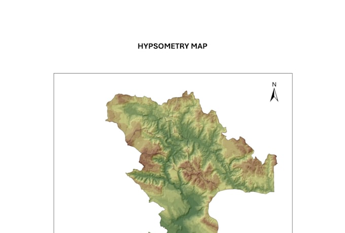
Need a professional, clear, and visually appealing GIS map?
I create custom maps using ArcGIS and QGIS for students, researchers, businesses, and personal projects. Whether you need a simple location map or a detailed thematic map, I will deliver a high-quality result suitable for presentations, reports, or publications.
What I can create:
Thematic maps (population, land use, climate, elevation, etc.)
Administrative and political maps
Topographic and terrain maps
Road and transportation maps
Land use and land cover maps
Custom map layouts for reports or academic work
Maps from your GIS data (Shapefiles, GeoJSON, KML, CSV, Excel)
High-resolution PNG, PDF, or JPEG exports
Why choose me?
-Accurate map design
-Professional cartographic layout
-Fast communication
-Revisions included
-High-resolution output
Please contact me before placing an order if your project includes complex spatial analysis or large datasets. This helps ensure the best results and an accurate delivery time.
Excel sheets, charts, and GIS
Talen
What files do you accept?
Shapefile, KML, KMZ, CSV, Excel, and other common GIS formats
What software do you use?
ArcGis pro.
Can you create a map from an image?
Yes, in many cases, as long as sufficient information is available