Door categorieën bladeren
Nederlands
$
USD
Maak verbinding met je AI
GIS Specialist Flood Risk, Land Use Watershed Mapping in ArcGIS QGIS
Skills
Bekijk mijn diensten

GIS Assistant
Khyber Pakhtunkhwa Health Care Commission • Fulltime
Aug 2022 - Jan 2024 • 1 yr 5 mos
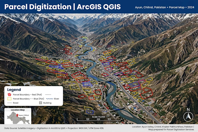
Worked with Board of Revenue, Khyber Pakhtunkhwa on digitization of land records and cadastral mapping. Key responsibilities: - Digitized Mauza / Khasra maps, cadastral sheets, and land parcels from paper maps, PDFs, and satellite imagery - Georeferenced revenue maps and aligned them with Google Earth and field GPS data - Created parcel shapefiles with Khasra number, Mauza, Tehsil, District, and area in Kanal / Marla - Verified land boundaries, resolved overlapping parcels, and cleaned topology errors - Prepared Land Use, Mouza maps, and print-ready layouts for revenue and planning departments - Worked in ArcGIS, QGIS, and Google Earth Pro Delivered accurate, revenue-record-ready GIS data for land administration and settlement work.

GIS Expert
DHA Lahore • Fulltime
Apr 2022 - Aug 2022 • 4 mos
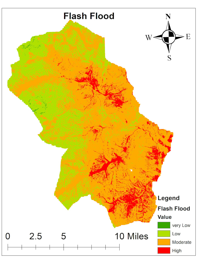
Worked as GIS Officer at DHA on GIS mapping, flood hazard mapping, and risk assessment for development and planning projects. Key responsibilities: - Flood Hazard Mapping & Flood Risk Mapping using DEM, river network, rainfall data, and slope analysis - Created Flood Hazard Zones, Vulnerable Areas, and Risk Maps for Ayun, Chitral and other flood-prone areas - Digitized plots, parcels, site layouts, and project boundaries from PDFs, images, AutoCAD, and satellite imagery - Georeferenced site plans, revenue maps, and flood maps, and aligned them with Google Earth and GPS / field survey data - Created shapefiles and KML files with complete attribute tables - Plot No., Khasra No., Area, Land Use, and Flood Risk Level - Prepared Land Use, Flood Risk, Site Layout, and Project Progress Maps with print-ready layouts - Verified boundaries, cleaned topology errors, and maintained accurate area calculation in Kanal / Marla and Acres Worked in ArcGIS, QGIS, Google Earth Pro, and Remote Sensing for accurate, decision-ready GIS delivery.

Assistant manager GIS
GRANA • Fulltime
Jun 2019 - Feb 2022 • 2 yrs 8 mos
Deputy Manager GIS - Grana Led GIS team for parcel digitization, topology checking, and rectification of housing schemes. Digitized land parcels with high accuracy using ArcGIS / QGIS Performed topology checks and fixed errors (gaps, overlaps, slivers)Rectified housing scheme layouts and parcel boundaries Managed team workflow and quality control for GIS data Delivered clean, topology-corrected GIS datasets for real estate projects
