Ik doe GIS mapping en spacial analysis en geocoding in arcgis

J
jimmy4670
J
jimmy4670
Jim J
Sommige informatie is automatisch vertaald.

Over deze dienst

Automatische vertaling

Met uitgebreide ervaring in ArcGIS bied ik een breed scala aan diensten, waaronder:

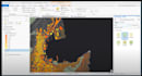
  1. GIS mapping: Je data omzetten in visueel aantrekkelijke kaarten die informatie en inzichten effectief communiceren. Of je nu thematische kaarten, choroplethkaarten of op maat gemaakte kaarten nodig hebt, ik help je graag.
  2. Spacial analysis: Gebruik maken van de kracht van spatial analytics om patronen, trends en relaties in je data te ontdekken. Van nabijheidsanalyse tot hot spot analyse, ik gebruik geavanceerde technieken om waardevolle inzichten te halen.
  3. Geocoding: Je data nauwkeurig georefereren om locaties op kaarten te visualiseren en spatial queries met precisie uit te voeren. Of je nu adressen, coördinaten of plaatsnamen hebt, ik zorg voor een naadloze integratie in je GIS-projecten.


Maak kennis met Jim J

Jim J
1,3(1)
  • Afkomstig uitKenia
  • Lid sindsjan 2024
  • Laatste levering2 jaar
  • Talen

    Engels
With a keen eye for detail, my site investigation expertise ensures a solid foundation, considering topography, climate, and local regulations. I specialize in strategic planning, crafting detailed and optimized blueprints tailored to your needs. From conceptualization to implementation, my commitment to precision is unwavering. Elevate your space with my inspired interior design, harmonizing functionality and style for a truly unique ambiance. With clear communication and a dedication to excellence, I bring [X] years of proven success to your project.

Automatische vertaling