Ik voer vector- en rasterbeeldanalyse uit

J
joenike
J
joenike
Ike C.a

Level 1

Sommige informatie is automatisch vertaald.

Over deze dienst

Automatische vertaling

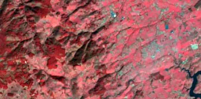
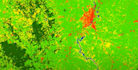
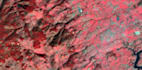
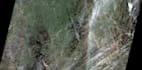
De dienst draait helemaal om rasterbeeldanalyse, met als doel het verkrijgen en leveren van verwachte resultaten. Dit omvat analyses zoals normale beeldclassificatie, DEM, NDVI, oppervlaktetemperatuur, drainagebekken en systeem, vectorextractie, helling, 3D-weergave, en zo verder. Het hangt volledig af van wat de klant wil.

Maak kennis met Ike C.a

Ike C.a
5,0(23)

Level 1

  • Afkomstig uitNigeria
  • Lid sindsmei 2020
  • Laatste levering5 maanden
  • Talen

    Engels
Work experience: Real time field data collection and monitoring, in compliance with required quality. Static and online relational map production and designing. Creation of comprehensive database. Projects Completed: GIS enabled Assets mapping and Customer enumeration for EEDC, mapping and analysis of power lines and metro stations within the country. Area of Specialization: Basically in to GIS data analysis and interpretation. And with that have gathered strength in the use of basic tools like: ArcGIS, QGIS, Surfer, Ilwis, Safe-FME Desktop, PostgreSQL, Global mapper, and GIS Cloud.

Automatische vertaling

Gerelateerde tags