Door categorieën bladeren
Ontdekken
Fiverr Pro
Nederlands
$
USD


Dear Sir,
I would be happy to chat with you before placing an order about adjusting the project scope, cost and timeframe to match your specific requirements. Thanks.
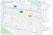
I specialize in creating accurate sewer, drainage, pipeline and water distribution maps for engineering, infrastructure, utility and planning projects.
What I will provide:
1. Sewer network and utility mapping
2. Drainage and stormwater infrastructure maps
3. Pipeline route and alignment maps
4. Water distribution network maps
5. Roads, manholes, inlets and utility features
6. Clean layouts with labels, legends and annotations
Why work with me:
1. Accurate and detailed mapping
2. Professional cartographic presentation
3. Organized and easy-to-read deliverables
4. Careful handling of project data
5. Reliable communication and timely delivery
I can work with available GIS data, CAD drawings, shapefiles, spreadsheets and other relevant project information. Whether you need a new utility map, an updated network layout or detailed infrastructure visualization, I can create a professional result suited to your project details and get a custom quote.
GIS mapping specialist
Talen
What types of utility maps can you create?
I can create sewer, drainage, pipeline and water distribution maps, including network routes, manholes, inlets, valves, roads and related infrastructure.
Can you create maps from existing engineering drawings?
Yes. I can use existing CAD, PDF, GIS or other project data to create clear and organized utility and infrastructure maps.
Can you customize the map to my project standards?
Yes. I can customize layers, labels, symbols, legends, layouts, coordinate systems and other project requirements.
What do you need to start the project?
Please provide your available project data, drawings, specifications, location information and any mapping standards or examples you want followed.


