k
kumaripuspa007

PUSPA

@kumaripuspa007

Remote sensing and GIS

India
Engels, Hindi, Bengaals
Sommige informatie wordt in het Engels weergegeven.
Over mij
Hello! I am a GIS enthusiast with a Master's degree in Geography, specialization in cartography. I have good knowledge of GIS and Remote Sensing using ArcGIS and QGIS, Google Earth Pro. I work with satellite data such as as Landsat and Digital Elevation Model (DEM) for spatial analysis. I can create Land use Land cover (LULC) maps, and terrain visualization. I also create topographic map and -basic geological maps for academic and project purposes. I am hardworking, detail-oriented and always focused on delivering accurate and high-quality results.... Lees meer

Skills

k
kumaripuspa007
PUSPA
offline • 
Gemiddelde reactietijd: 1 uur

Bekijk mijn diensten

Grafische vormgeving
I will create muiti temporal lulc maps ,thematic maps, elevation map

Portfolio

Werkervaring

Research Paper

Banaras Hindu University • ZZP

Jun 2019 - Dec 20212 yrs 6 mos

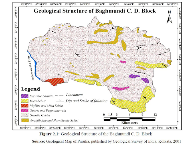
Researcher (M.A Geography Dissertation). I have hands on experience In GIS through my academic dissertation where I worked on -satellite image classification, LULC mapping, developed thematic maps including soil, topography, drainage, vegetation and geology using Arc GIS and Remote sensing data