Door categorieën bladeren
Ontdekken
Fiverr Pro
Nederlands
$
USD

Level 2


Malik Fahad is geselecteerd door het team van Fiverr Pro vanwege diens expertise.
Automatische vertaling
Hoi! Ik ben Malik, een professionele en enthousiaste GIS Engineer en Spatial Data Scientist.
>> Expertisegebied:
⭐️ GIS Data Engineering
⭐️ GIS Web Map Ontwikkeling
⭐️ Geo Spatial Apps Ontwikkeling
⭐️ Webontwikkeling
⭐️ Auto CAD Civil 3D Map Ontwerp
⭐️ CAD naar GIS Conversie en Data Cleaning
⭐️ Database Ontwerp, Ontwikkeling en Implementatie
⭐️ Cartografie
⭐️ Topografische Kaartlegging
⭐️ Ruimtelijke Analyse
⭐️ Satellietbeeldverwerking Expert
⭐️ Geo-Portal Ontwikkeling
⭐️ Python Ontwikkeling
⭐️ FME - ETL en Data Integratie
⭐️ Grafisch Ontwerp
⭐️ Dashboard Ontwikkeling
⭐️ Webontwikkeling
⭐️ App Ontwikkeling
⭐️ Grafisch Ontwerp
⭐️ PowerPoint Presentaties
⭐️ Info-Graphics
⭐️ Remote Sensing
⭐️ Spectrale Analyse
>> Software Expertise:
Bedankt dat je mijn profiel hebt bezocht...!
Stuur me een bericht om te laten weten hoe ik je kan helpen..!
GIS Expert, Remote Sensing, Data Analyst, FME, Graphic Design, Excel
Level 2
Malik Fahad maakt deel uit van de Fiverr Pro-catalogus en is zorgvuldig uitgekozen door het Fiverr Pro-team vanwege zijn of haar vaardigheden en expertise.
Gescreend voor
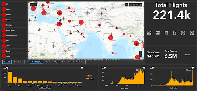
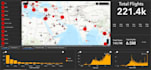
Datavisualisatie
Talen
Automatische vertaling
Automatische vertaling
Bied je maatwerk diensten aan?
Ja, ik bied ook on-demand diensten aan.
| (1) | ||
| (0) | ||
| (0) | ||
| (0) | ||
| (0) |

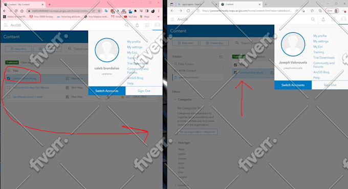
calebbrandalise

Verenigde Staten
Super quick, jumped on vid chat, addressed possibilities, and executed like a champ! Well versed with ARCgis & seemingly the python etc to help string things together just right.. Appreciate the quick turn around too.
| (1) | ||
| (0) | ||
| (0) | ||
| (0) | ||
| (0) |
calebbrandalise
Verenigde Staten
Super quick, jumped on vid chat, addressed possibilities, and executed like a champ! Well versed with ARCgis & seemingly the python etc to help string things together just right.. Appreciate the quick turn around too.