Door categorieën bladeren
Ontdekken
Fiverr Pro
Nederlands
$
USD

Level 2
Automatische vertaling
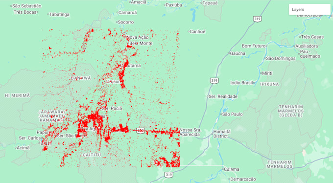
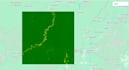
BOUWBOS KOOLSTOFVOORRAAD & BIOMASSA MAPPING REDD+ MRV KLAAR
Ben je bezig met een koolstofkredietproject, REDD+ baseline of
EUDR-conforme supply chain? Ik lever nauwkeurige, wetenschappelijke
bosbouw koolstofdata met behulp van satelliet remote sensing, volgens
IPCC 2019 richtlijnen.
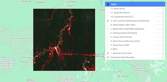
DATASOURCES
Sentinel-1/2, Landsat 8/9, Hansen GFC, UN WCMC Biomass,
NASA GEDI LiDAR.
WAT JE KRIJGT
- Bovengrond Biomassa kaart (t/ha)
- Koolstofvoorraad kaart (tC/ha)
- CO2-equivalent kaart (tCO2e/ha)
- Ontbossing & verandering detectie
- Professioneel PDF rapport met grafieken
- GIS-bestanden: GeoTIFF, Shapefile, KMZ
PERFECT VOOR
Koolstofkredietontwikkelaars, REDD+ MRV, agroforestry, EUDR
naleving, natuurbehoud NGO’s, onderzoekers, overheden.
WAAROM KIEZEN VOOR MIJ
- Geoloog met sterke remote sensing expertise
- Verra & Gold Standard compatibele methodologie
- Snelle en duidelijke communicatie
- Op tijd leveren
Neem contact met mij op voordat je bestelt met je projectgebied en doelen
voor een aangepaste offerte.
Level 2
Talen
Automatische vertaling