Door categorieën bladeren
Ontdekken
Fiverr Pro
Nederlands
$
USD


Automatische vertaling
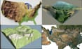
Heb je moeite om contourlijnen, topografische kaarten, Google Earth-locaties of hoogtedata om te zetten in nauwkeurige 3D-terreinmodellen? Of je nu architect, ingenieur, landmeter, stedenbouwkundige, game-ontwikkelaar, onderzoeker of 3D-printliefhebber bent, ik kan je helpen om precieze, hoogwaardige terreinmodellen te maken die op jouw project zijn afgestemd.
Ik ben gespecialiseerd in het omzetten van DEM-data, contourlijnen, topografische kaarten en hoogtedata uit de echte wereld in gedetailleerde 3D-terreinmodellen die geoptimaliseerd zijn voor visualisatie, presentaties, simulaties, bouwplanning, GIS-projecten en 3D-printen.
Wat je krijgt:
Ik zet me in om werk van hoge kwaliteit te leveren met aandacht voor detail, zodat jouw terreinmodel de echte landschap nauwkeurig weergeeft en aan je projectvereisten voldoet.
Neem contact met mij op voordat je een bestelling plaatst zodat we je project, data en gebiedsmaat kunnen bespreken
Laat het de freelancer weten als je voorkeuren voor of zorgen hebt over het gebruik van AI-tools voor het voltooien en/of leveren van je bestelling.
Map Designer
Talen
Automatische vertaling
