Het lijkt erop dat deze dienst tijdelijk niet beschikbaar is

Ik maak professionele kaarten en voer geospatiale analyse uit

M
mcneill_intel
M
mcneill_intel
Scott McNeill
Sommige informatie is automatisch vertaald.

Over deze dienst

Automatische vertaling

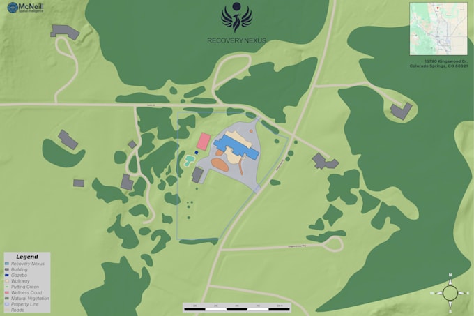
Ik maak professionele kaarten en geospatiale producten voor vastgoed, landgebruik, bouw en zakelijke toepassingen. Leveringen omvatten hoogwaardige kaartexports en optionele ruimtelijke data-bestanden.

Maak kennis met Scott McNeill

Scott McNeill

Geospatial Analyst, Software Engineer

  • Afkomstig uitVerenigde Staten
  • Lid sindsjan 2026
  • Gem. reactietijdBinnen 4 dagen
  • Talen

    Engels
McNeill Spatial Intelligence (MSI) provides professional drone imaging and geospatial data services based in Houston, Texas. We specialize in commercial aerial photography, construction progress documentation, inspections, and GIS-ready mapping deliverables. FAA Part 107 licensed, MSI delivers high-resolution 4K imagery and structured spatial data designed for real-world use. Clear communication, reliable execution, and measurable results.

Automatische vertaling

Mijn portfolio