Ik maak professionele gis-kaarten, webkaarten en ruimtelijke analyse

M
mike_ess
M
mike_ess
Michael G
Sommige informatie is automatisch vertaald.

Over deze dienst

Automatische vertaling

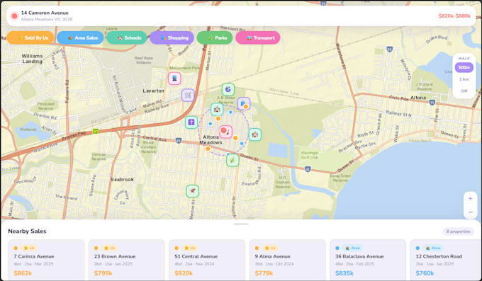
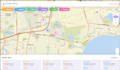
Ik bied professionele GIS-mapping, ruimtelijke analyse en ondersteuning bij geospatiale projecten met behulp van industriestandaard tools. Dit Basic Package (tot 3 uur werk) is ideaal voor kleine GIS-taken, planningsondersteuning en vroege projectontwikkeling.


Waar ik mee kan helpen:

  • Op maat gemaakte GIS-kaart creatie (Webapp, zowel mobiel als browser gebaseerd)
  • Ruimtelijke analyse (buffer, overlay, geschiktheid & locatiekeuze analyse)
  • Data conversie (SHP, KML, GeoJSON, CAD)
  • Data schoonmaak, geocodering en voorbereiding van ruimtelijke data
  • Survey123 formulierontwerp en setup (basisworkflows)
  • GIS-projectplanning en workflow ondersteuning
  • Kaartoutputs voor rapporten, presentaties en besluitvorming

Perfect voor:

  • Planning en projectscope werk
  • Kleine GIS-analyse taken
  • Vroege ontwikkelings- of haalbaarheidsmapping
  • Data voorbereiding en organisatie
  • Project

Wat je ontvangt:

  • Duidelijke, nauwkeurige GIS-kaarten en outputs
  • Schoon ruimtelijk datasets
  • Klaar-voor-gebruik bestanden in jouw voorkeursformaat


Gebruikte tools: ArcGIS Pro, ArcGIS Online, Survey123, QGIS.


Voel je vrij om me te berichten voordat je bestelt om je project te bespreken.


Trefwoorden: GIS mapping, ruimtelijke analyse, ArcGIS, QGIS, Survey123, geospatiale analyse, data conversie, cartografie, webkaarten, planningskaarten,

Maak kennis met Michael G

Michael G

Senior GIS Data Analyst Australia

  • Afkomstig uitAustralië
  • Lid sindsnov 2025
  • Talen

    Engels
Australian Senior GIS & Data Analyst with experience across government sectors, local government, engineering consultancy, environmental work and property. I build custom web maps, interactive story maps, and spatial data tools using , ArcGIS (Esri suite), QGIS, Leaflet.js and more. Outside my day job I run Echidna Spatial Solutions — a boutique GIS consultancy delivering bespoke spatial web apps for property, tourism, and beyond. I hold a BSc in Geospatial Science (Honours) and love making GIS work accessible to businesses that wouldn't normally have it.

Automatische vertaling