Door categorieën bladeren
Ontdekken
Fiverr Pro
Nederlands
$
USD
Climate Risk and Geospatial Specialist, NatCat, Flood, GIS and Remote Sensing
Your satellite data is worth more than a screenshot. Let me turn it into decision-ready maps and analyses your team can actually use.
WHAT I BUILD:
Regional and site-level thematic maps (QGIS, print-ready A4/A3)
Vegetation health and land cover analysis (NDVI, classification)
Terrain and elevation analysis (DEM, slope, aspect, TWI)
Change detection how has land use shifted over time
Interactive web maps for reports and stakeholders
Full QGIS project handover so your team can update it
WHY ME:
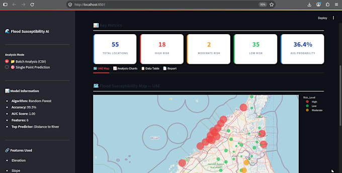
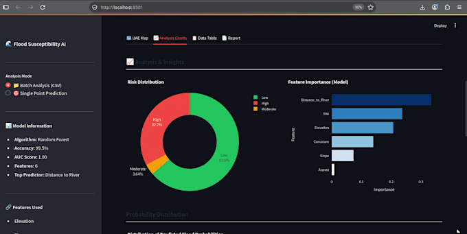
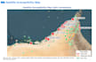
UAE flood susceptibility model 99.5% accuracy, AUC 1.00
Print-ready cartographic maps with legend, scale bar, north arrow
Full GIS pipeline from raw satellite to final handover
M.Sc. Geophysics, 13+ years international experience
All outputs documented and reproducible
WHO HIRES ME:
Urban planners and land-use analysts
Environmental and agricultural consultancies
Mining, energy, and infrastructure teams
NGOs and government agencies
HOW IT WORKS:
Send me your area of interest and what decision you're trying to support. I reply within 12 hours with scope, timeline, and recommended tier.
Delivery: 3 - 12 days.


What data do you need from me?
Just the region or area of interest — address, coordinates, or shapefile. I source satellite and DEM data unless you have your own to provide.
Can you work with my own imagery or GIS files?
Yes. I work with GeoTIFF, JPEG2000, shapefiles, GeoJSON, CSV with lat/long, and any standard GIS format. Send a small sample and I'll confirm.
What output formats do you deliver?
PNG maps (300 DPI, print-ready), GeoTIFF (georeferenced raster), interactive HTML maps, and PDF reports. Full QGIS project file on Premium tier.
Can you handle any region worldwide?
Yes, globally. Any continent, any scale — from a single site to a country. Arid and coastal environments are my specialty.
Do I own the output and the source files?
Yes. Full commercial rights to all maps, code, and data products. You receive everything you need to reuse or extend the work.