Ik ontwerp kaarten, arcgis kaarten en gis projecten

M
mutemit
M
mutemit
Titus Mutemi
Sommige informatie is automatisch vertaald.

Over deze dienst

Automatische vertaling

Hallo daar...

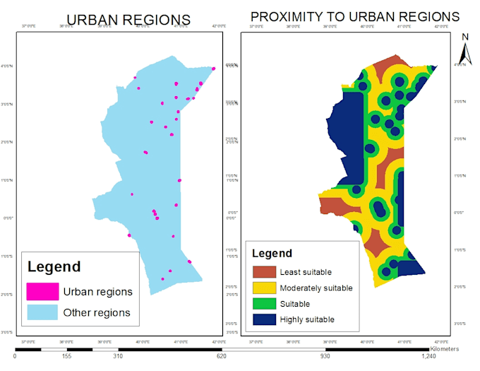
Ik ontwerp topografische kaarten, analytische kaarten, ruimtelijke analyses en alle ArcGIS projecten.

Ik maak DEMs van Google Earth, contouren en sitekaarten.

Ik gebruik satellietbeelden voor classificatie met behulp van Erdas Imagine en ArcGIS.

Maak kennis met Titus Mutemi

Titus Mutemi

Geomatics Engineer,GIS Analyst

  • Afkomstig uitKenia
  • Lid sindsdec 2022
  • Talen

    Engels
Hello there..I am a trained Surveyor and GIS(Geographic Information Systems) Analyst. I hold a bachelors degree in Geomatics Engineering and GIS & Remote Sensing. I have a 6 years experience in this field and expert in using various GIS software including QGIS, ArcGIS, Global Mapper, Google Earth and related. Survey software; AutoCAD, Civil 3D. Remote Sensing software; Envi and Erdas Imagine.

Automatische vertaling