Door categorieën bladeren
Ontdekken
Fiverr Pro
Nederlands
$
USD
Level 1

Automatische vertaling
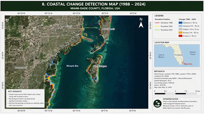
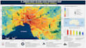
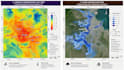
Transformeer ruwe locatiegegevens in bruikbare inzichten met deskundige GIS, Remote Sensing en GIS Mapping diensten. Ik lever geavanceerde ruimtelijke analyses, terreinmodellering en cartografie die klaar is voor publicatie met behulp van ArcGIS, QGIS en Python automatisering. Of je nu satellietbeelden wilt classificeren, landgebruikveranderingen detecteren, netwerkrouting of aangepaste geoprocessing scripts nodig hebt, ik zet complexe datasets om in duidelijke visuele intelligentie. Mijn werkwijze garandeert strikte topologische nauwkeurigheid, geoptimaliseerde geodatabases en naadloze data-integratie voor milieuprojecten, stedelijke planning en bedrijfsinformatie. Ik verwerk shapefiles, GeoJSON, LiDAR, NDVI, ruimtelijke statistieken en enterprise databases. Ik ben gespecialiseerd in het genereren van high-resolution orthomosaics, hydrologisch modelleren, geschiktheidsanalyses en geautomatiseerde batchverwerkingsworkflows. De opleveringen omvatten printklare lay-outs, interactieve dashboards en geautomatiseerde Python-toolboxes die precies aansluiten bij jouw specificaties. Elk project bevat nauwkeurige georeferentie, schone metadata en snelle doorlooptijden voor academisch of commercieel gebruik. Plaats nu je bestelling voor professionele geospatiale oplossingen die slimmere beslissingen mogelijk maken. Laten we vandaag nog jouw succes in kaart brengen!
GIS and Remote Sensing Specialist
Level 1
Talen
Automatische vertaling
Automatische vertaling
Moet ik de ruimtelijke data aanleveren, of kan jij die vinden?
Je kunt je eigen data aanleveren (Shapefiles, GeoTIFFs, CAD, CSVs). Als je geen data hebt, zoek ik hoogwaardige open-source satellietbeelden, OpenStreetMap-data of openbare overheidsdatasets die je project nodig heeft.
Welke software gebruik je: ArcGIS, QGIS of Python?
Ik kies het beste gereedschap voor jouw behoeften. ArcGIS voor enterprise workflows, QGIS voor open-source flexibiliteit, en Python voor geavanceerde automatisering en complexe ruimtelijke analyses. Ik pas me aan jouw voorkeurs ecosysteem aan.
Welke bestandsindelingen ontvang ik na voltooiing?
De opleveringen worden op jou afgestemd. Ik lever standaard vectorformaten (Shapefile, GeoJSON, KML, Geodatabase), rasters (GeoTIFF), hoge-resolutie kaartlay-outs (PDF, PNG, JPEG), en Python scripts (.py) of Jupyter Notebooks.
Welke specifieke remote sensing en satellietanalyses bied je aan?
Ik bied Land Use/Land Cover (LULC) classificatie, NDVI/vegetatie-analyse, veranderingdetectie, supervised/unsupervised classificatie, orthomosaic generatie, en multispectrale beeldverwerking.
Kun je aangepaste Python scripts schrijven om mijn GIS-taken te automatiseren?
Ja! Ik schrijf aangepaste Python scripts met ArcPy, PyQGIS, GeoPandas en Rasterio. Ik automatiseer repetitieve geoprocessing, batch data conversies en complexe ruimtelijke analyses om je tijd te besparen.
Hoe lang duurt het om een GIS-mapping project te voltooien?
Het hangt af van de complexiteit. Eenvoudige kaarten duren 1-2 dagen, terwijl complexe remote sensing of Python automatisering 3-5 dagen kan kosten. Stuur me een bericht met je wensen voor een exacte planning!
Worden mijn ruimtelijke data en projectinformatie vertrouwelijk behandeld?
Ja, 100%. Ik neem dataprivacy serieus. Al je datasets, eigendomsinformatie en opleveringen blijven strikt vertrouwelijk en worden nooit zonder jouw toestemming gedeeld met derden.
Wat als ik wijzigingen wil aan de uiteindelijke kaartlay-out of analyse?
Jouw tevredenheid staat voorop. Ik bied revisies aan om te zorgen dat kaartsymboliek, lay-out, labels, legenden en analyseresultaten perfect aansluiten bij jouw wensen. Bekijk mijn pakketten voor revisielimieten.
Mag ik jouw opleveringen gebruiken voor academische of commerciële projecten?
Ja! Ik lever publicatieklare kaarten en nauwkeurige ruimtelijke analyses, perfect voor academische theses, onderzoeksartikelen, stedelijke planning, milieubeheer en commerciële business intelligence.
Mijn project is uniek en complex. Hoe beginnen we?
Elk project is uniek! Stuur me een bericht met je details, doelen en data-behoeften. Ik bekijk ze en stuur je een op maat gemaakte offerte die precies past bij jouw scope en budget voordat je bestelt.