I will process drone photogrammetry images into 3d models, maps

N
neamulahsankhan
N
neamulahsankhan
Neamulahsankhan
Sommige informatie wordt in het Engels weergegeven.

Over deze dienst

About This Gig

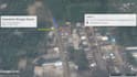
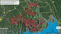
Unlock the power of aerial data with professional drone photogrammetry! I specialize in capturing high-resolution imagery and transforming it into accurate, detailed maps and 3D models. Whether you need precise measurements, topographic surveys, or stunning visualizations, my drone photogrammetry service delivers high-quality results tailored to your project needs.

What I Offer:

  • Aerial Surveying and Mapping: Capture extensive areas with high-precision, georeferenced maps and orthophotos.
  • 3D Modeling and Reconstruction: Generate realistic 3D models for construction, urban planning, and landscape design.
  • Topographic Surveys: Create detailed contour maps and terrain models for land assessments and project planning.
  • Volume Calculations: Accurately measure stockpile volumes for mining, construction, or agricultural projects.
  • Site Monitoring: Track changes and monitor project progress with regular aerial updates.
  • Agricultural Analysis: Perform crop health assessments and vegetation analysis using multispectral imagery.

Why Choose Me?

  • Experienced Pilot and GIS Professional: Combining drone piloting with GIS expertise ensures precise and actionable results.
  • State-of-the-Art

Maak kennis met Neamulahsankhan

Neamulahsankhan

Let's make your Web map quick, efficient and afordable

5,0(1)
  • Afkomstig uitBangladesh
  • Lid sindsfeb 2022
  • Gem. reactietijd1 uur
  • Laatste levering1 jaar
  • Talen

    Engels
I'm a GIS & Remote Sensing Expert, I do manipulation of complex databases and spreadsheets, Paper Map Digitization, Remote Sensing, Web Maps all other Map production works.

Mijn portfolio

Andere Datavisualisatie diensten die ik aanbied