Ik zal topografische bladsatellietbeelden digitaliseren in arcgis

N
nomi_solutions
N
nomi_solutions
Nouman Ijaz

Level 1

Sommige informatie is automatisch vertaald.

Over deze dienst

Automatische vertaling

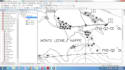
Welkom bij mijn dienstik digitaliseer topografische kaarten, satellietbeelden of andere afbeeldingen/kaarten in Arcgis
ik zal

  • Geo-referentie
  • Digitaliseer je rastergegevens om ze om te zetten in vectorvorm
  • Deel het vectorbestand in de volgende formaten: shapefiles, Geodatabase, Kml, Kmz, Eps, Ai, etc
  • Maak een duidelijke professionele kaart

ik doe mijn werk om jou 100% tevredenheid te bieden

Prijs is bespreekbaar

Neem contact met me op voordat je een bestelling plaatst!
Dank je wel
Beste wensen!!!
Nomi
Maak kennis met Nouman Ijaz

Nouman Ijaz

GIS Specialist and Google Earth Expert

4,4(233)

Level 1

  • Afkomstig uitPakistan
  • Lid sindsdec 2016
  • Gem. reactietijd1 uur
  • Laatste levering1 dag
  • Talen

    Engels
Hello, I am Nouman Ijaz, a professional GIS Analyst with several years of experience in GIS and RS. I specialize in transforming spatial data into accurate, meaningful, and visually clear maps and geospatial. I have worked on a wide range of GIS projects involving mapping, spatial analysis, satellite imagery processing, and geospatial data management for business, environmental, and planning purposes. I am highly skilled in industry-standard tools such as ArcGIS, QGIS, Google Earth Pro, and Google Earth Studio, and I use these tools to deliver high-quality geospatial solutions.

Automatische vertaling

Mijn portfolio