Door categorieën bladeren
Nederlands
$
USD
Koppel je AI aan Fiverr



Automatische vertaling
Nodige nauwkeurige satelliet-remote-sensing-analyse en publicatie-klare kaarten in 300 DPI met Google Earth Engine (GEE), ArcGIS Pro en QGIS?
Ik specialiseer me in cloud-gebaseerde geospatiale verwerking en satellietgegevensanalyse voor academisch onderzoek, landbouw en milieubewaking.
Kerndiensten GEE & Remote Sensing:
- LULC-classificatie: supervised classification (Random Forest, SVM, CART), gebiedsstatistieken & detectie van veranderingen.
- Spectrale indices: NDVI, SAVI, EVI, NDWI, NDBI & multi-index bodem-saliniteit (S1, S2, SI).
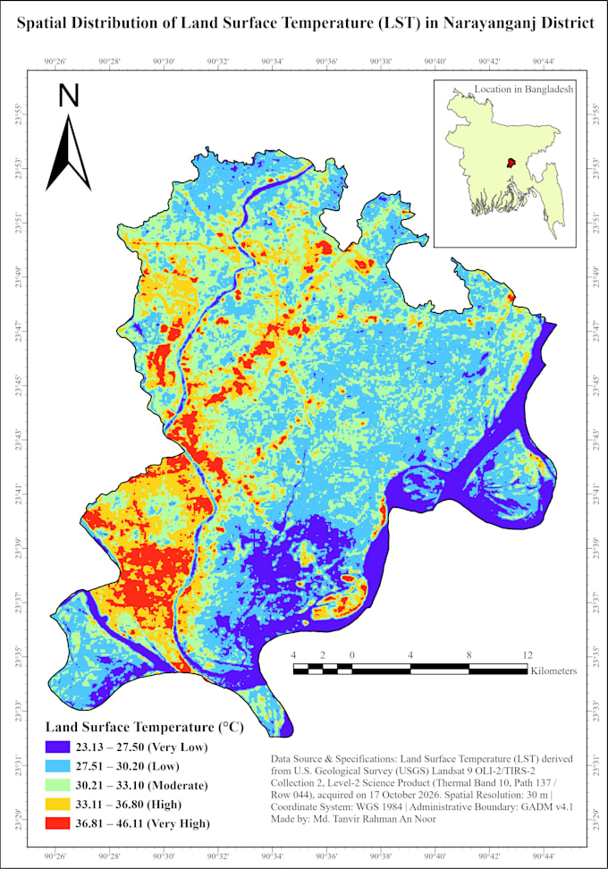
- Thermisch & Klimaat: landoppervlakte-temperatuur (LST) via Landsat 8/9, thermische hotspots & CHIRPS neerslagtrends.
- Radar & Luchtkwaliteit: Sentinel-1 SAR overstromingskaart & Sentinel-5P vervuilingskaart (NO2, CO).
- Cartografie: exporteren van GEE-rasters naar ArcGIS Pro/QGIS voor 300 DPI multi-panel tijdschriftindelingen.
Opleveringen:
- Kaarten van 300 DPI (PNG, JPEG, PDF, TIFF)
- GeoTIFF-rasters, shapefiles & CSV-statistische tabellen
- Schone, reproduceerbare Google Earth Engine (JavaScript) code
Stuur me een bericht met jouw studiegebied (ROI) en tijdsbestek voordat je bestelt!
GIS, Remote Sensing and Geospatial Data Analyst
Talen
Automatische vertaling
Automatische vertaling
Kun je de Google Earth Engine (GEE) JavaScript-code en GeoTIFF-bestanden leveren?
Ja! Naast de 300 DPI-publicatieklare kaartlay-outs kan ik het volledige reproduceerbare GEE-script leveren, verwerkte GeoTIFF-rasters, shapefiles en CSV-gegevenstabellen.
Welke satellietdatasets gebruik je voor LULC, NDVI, LST en flood-mapping?
Ik werk met Landsat 5/8/9, Sentinel-2 (multispectral), Sentinel-1 SAR (radar overstromingskaart), Sentinel-5P (luchtkwaliteit), MODIS, Copernicus DEM en CHIRPS-neerslagdatasets, afhankelijk van jouw onderzoeksbehoeften.