Ik maak web gis en interactieve mapping

N
nursalam231
N
nursalam231
Ripan Nursalam
Sommige informatie is automatisch vertaald.

Over deze dienst

Automatische vertaling

Ripan Nursalam | WebGIS & Ruimtelijke Ontwikkelaar

Vers Talent | Klaar om te Bouwen & Implementeren


Portfolio Hoogtepunten

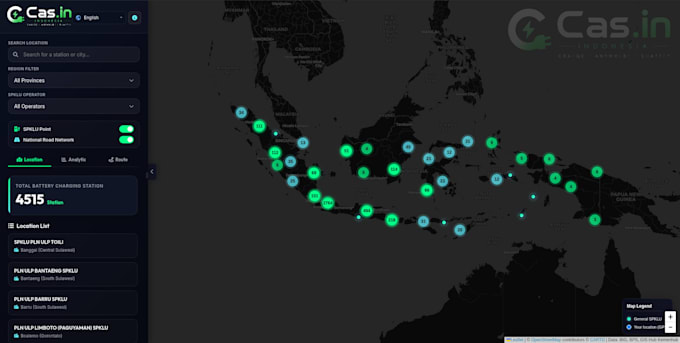
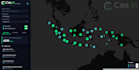
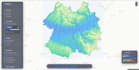
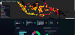
Cas.in EV Oplaadstation Mapping Platform (Live)

https://cas-in.nsurbanist.cloud/

Gebouwd vanaf nul, geïmplementeerd op VPS, met routing, GPS en batterij simulatie.


Kernvaardigheden

  • WebGIS & Mapping : Leaflet JS, Mapbox GL JS, OpenLayers
  • Frontend : React JS, JavaScript, HTML5, CSS3
  • Backend : Node.js, Python (Django/Flask)Ruimtelijk
  • Database : PostgreSQL, PostGISData FormatsGeoJSON, Shapefile, KML, CSV
  • Implementatie : Linux, Nginx


Diensten die ik aanbied

  • Aangepaste WebGIS & interactieve kaarten
  • Ruimtelijke dashboards & datavisualisatie
  • PostgreSQL / PostGIS database setup
  • GPS-integratie & routeplanning
  • VPS-implementatie (productieklaar)


Waarom voor mij kiezen?

  • Ik lever live, werkende systemen, niet alleen code
  • Ik verzorg end-to-end implementatie zodat jij niet hoeft
  • Ik communiceer duidelijk en reageer snel
  • Mijn portfolio-project is live en getest


Laten we eerst bespreken

We bespreken eerst je data, gebruikers en budget, daarna adviseer ik de beste aanpak.

Neem contact met me op. Ik reageer zo snel mogelijk.

Maak kennis met Ripan Nursalam

Ripan Nursalam

GIS Specialist, Urban Modeling, Spatial Planning , Data Analyst

  • Afkomstig uitIndonesië
  • Lid sindsjun 2026
  • Gem. reactietijd1 uur
  • Talen

    Indonesisch, Engels
My expertise lies at the intersection of AI, IT, and geospatial science. I leverage machine learning algorithms and spatial modeling to solve real-world urban challenges—from infrastructure planning to resource optimization. Crucially, I embed human oversight at every stage of the analysis, ensuring that automated insights are always grounded in practical, ethical judgment. I am driven by a singular goal: to build smarter, greener, and more inclusive cities using the power of spatial data.

Automatische vertaling

Mijn portfolio

Gerelateerde tags